


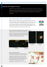
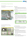
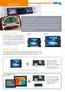
1
2 3
3
1
2
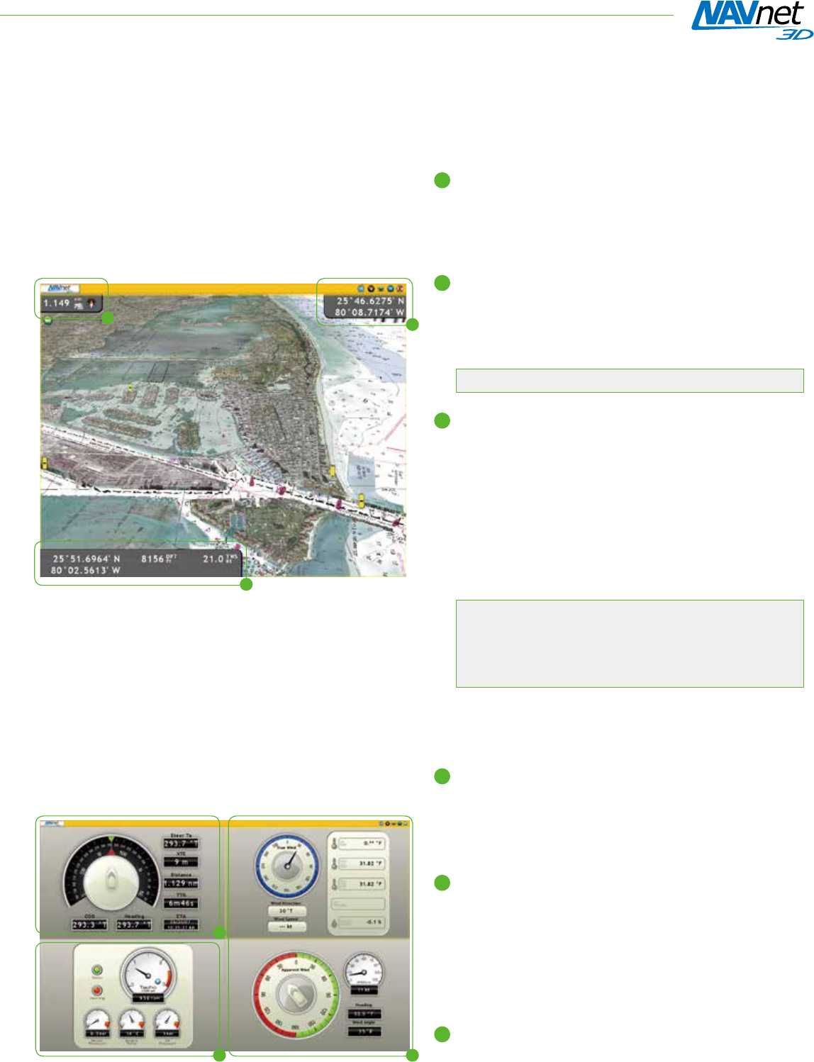
Range Data
Automatically changes range scale settings between long
range (mile, nautical mile or kilometer) and short range
(foot, meter or yard) according to the current display range.
Cursor Data
Shows the latitude and longitude position where the cursor
is on the chart.
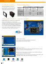
1
▲
Position
▲
Range
▲
Bearing
Ship’s Data
These user-specied data boxes allow you to display the
information you want to see. Customize the data boxes to
show single or multiple pieces of information. Click on the
box and it will show you the variety of data you can display.
When you select multiple data, it will rotate at a specied
time interval.
3
Information to be displayed
▲
Position
▲
COG
▲
SOG
▲
Depth
▲
SST
▲
STW
▲
Heading
▲
True Wind Speed
▲
True Wind Direction
▲
True Wind Angle
▲
Apparent Wind Speed
▲
Apparent Wind Angle
▲
ROT
▲
Trip Log
▲
Odometer
▲
Date and Time
Information to be displayed
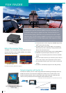
2
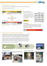
Compass Rose display
In the Compass Rose display, you can view the heading,
bearing to the waypoint and COG information at the same
time in order to see if your craft is on the right track.
Engine Monitoring
When interfaced with an engine that outputs data in
NMEA 2000
®
format, NavNet 3D can show an on-screen
engine monitoring display. The information displayed
includes: tachometer, boost pressure, engine temperature
and oil pressure.
Wind Speed and Direction
Either true or apparent wind speed and direction can be
shown, when interfaced with a wind sensor.
1
3
2
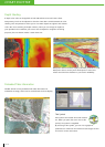
On-screen Navigational Instrument
NavNet 3D delivers various on-screen navigation
instrument displays.
NAV Data Display and Engine Monitoring
NAV Data Display
Selected NAV data can be shown at the edges of the screen
in nav data windows.