


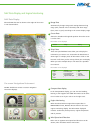
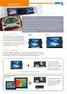
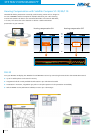
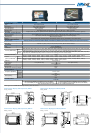
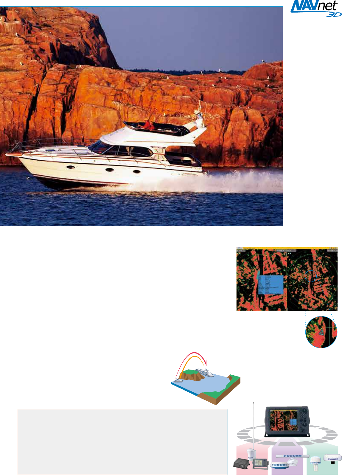
AIS Target Tracking
When FURUNO AIS FA-30/50/150 is interfaced with NavNet 3D, the AIS information
is integrated into the NavNet 3D network to facilitate enhanced monitoring of the
surrounding area from any station. Up to 100 AIS targets can be tracked and
displayed with ve different symbols to indicate their status. Detailed information
about a specic target can be viewed in a pop-up AIS data window when you select
the target with the cursor.
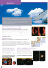
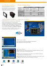
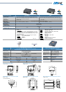
What is AIS?
The Automatic Identication System (AIS) improves the safety level of boating by
exchanging information about the status of your ship with other AIS-equipped craft
nearby. The system utilizes VHF broadcasts to handle information about the
surrounding area, such as other craft and buoys and other aids-to-navigation.
The AIS data includes target position, course and speed over
ground, allowing you to foresee the course changes of
particular targets. AIS targets are constantly visible even
when they are shrouded in fog or darkness, or hidden behind
headlands, river bends or other obstructions.
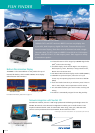
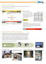
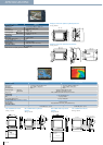
Dynamic Data
▲
Ship’s Position
▲
Coordinated Universal Time (UTC)
▲
Course over Ground (COG)
▲
Speed over Ground (SOG)
▲
Rate of Turn (ROT)
▲
Heading
▲
Navigation Status
Static Data
▲
MMSI (Maritime Mobile Service Identity)
▲
IMO Number
Information to be Exchanged
▲
Ship’s Name
▲
Type of Ship
▲
Call Sign
▲
Length and Beam
▲
Location of Position-Fixing Antenna on the Ship
Voyage-Related Data
▲
Ship’s Draft
▲
Hazardous Cargo
▲
Destination and Estimated Time of Arrival (ETA)
Safety-Related Messages
AIS
DATA