


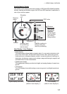


2-1
2. PLOTTER DISPLAY OVERVIEW
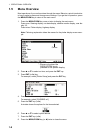
2.1 How to Select the Display Range
You can change the display range on the plotter and highway displays. The horizontal
range in the plotter display is available among 0.02, 0.05, 0.1, 0.2, 0.5, 1, 2, 5, 10, 20,
40, 80, 160 and 320 nautical miles. The horizontal range in the highway display is
available among 0.2, 0.4, 0.8, 1, 2, 4, 8 and 16 nautical miles.
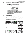
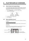
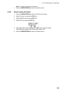
1. Press the MENU/ZOOM key on the plotter or highway display.
The following window appears.
2. Press S or T to select range you want.
3. Press the ENT key.
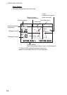
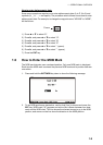
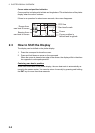
2.2 How to Shift the Cursor
Use the cursorpad to shift the cursor. The cursor moves in the direction of the arrow
or diagonal.
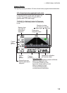
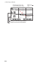
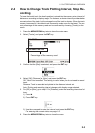
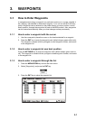
Cursor state and position indication
The position indication, shown at bottom of the plotter display, changes according to
cursor state.
Cursor at rest
When the cursor is not shown, boat’s position in longitude and latitude or TDs (de-
pending on the menu setting) appears at the bottom of the display.
(Plotter display) (Highway display)
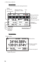
Own boat’s position
in latitude and longitude
Own boat
COG
(course over ground)
SOG
(speed over ground)
COG line
20.0
350