


User's manual OnCourse Navigator | 4
Additional software: MapExport - 80 -
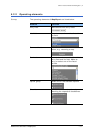
5.4 Exporting segments of the map
5.4.1 Corridor surrounding an itinerary
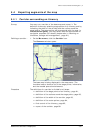
Survey You may cut a corridor of the base map and export it. The
definition is done by selecting stage points of an itinerary and by
indicating the width of the corridor and the radius round the
stage points. The stage points will be exported with the map. In
OnCourse Navigator, you may select them as destinations for
navigation purposes (For details, please refer to “Working on
itineraries, storage and management”, page 61).
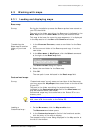
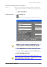
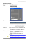
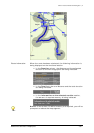
Defining a corridor… 1. On the M
AIN MENU, click the Corridor icon.
The C
ORRIDOR window opens:
The base map is being displayed in the map sector. The
functional sector shows a list of the stage points, information,
and the needed operational elements.
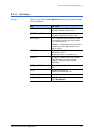
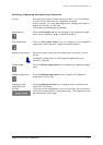
Procedure The definition of a corridor is divided into 6 steps:
Ù definition of the stage points of an itinerary, page 81,
Ù definition of the radius around the stage points, page 83,
Ù definition of the width of the corridor, page 83,
Ù definition of the route options, page 84,
Ù final control of the itinerary, page 85,
Ù export of the corridor, page 88.