


12
2.1
MAP PAGE
2.1
MAP PAGE
11
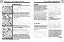
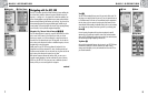
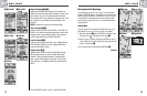
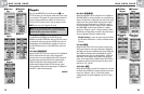
Using the Map Page
Moving Around: Panning
Moving Around the Map Image
From the Map page, you can zoom in or zoom out on the map image by
pressing the ZOOM IN/OUT button. The data field on the map image can be
hidden by selecting FULL MAP (see “Set Data Option”, page 10). A section
of map outside the current viewing area can be seen by panning. Details
about a waypoint, city/town, POI, track or route can be accessed while in
the panning mode.
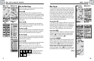
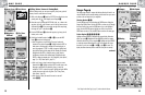
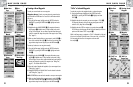
Panning Mode
To see any portion of the map image that is beyond the left, right, top, or
bottom edge of the screen, you can "pan" your view in any direction.
1. While on the Map page Ẅ, push the JOYSTICK in any direction to enter
panning mode. An arrow-shaped cursor will appear ẅ.
2. Move the cursor in any direction by pushing the JOYSTICK left, right, up
or down. When the cursor reaches an edge of the map image, the image
will “pan” in that direction Ẇ.
3. To exit panning mode, press and release the PAGE button ẇ.
continued
Ẅ Map Page
ẉ Map Details
Ẋ Show/Hide
Details
ẋ Auto Zoom
Ẍ Stop Nav
Option
ẗẻ Defaults
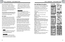
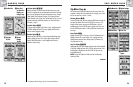
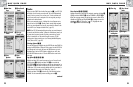
Map Detail Option ẅẉ Ẋ
Highlight and select DETAIL to show/hide any or all of the details to be
displayed on the map. Details shown include all waypoint, city/town, or POI
names; waypoint, city/town, or POI symbols; waypoints; cities/towns;
Points of Interest; track or travel completed so far; navigational track or route
and continental U.S. state, Canadian provincial and European country
boundaries.*
NOTE: All symbols will be replaced by a small dot when hidden.
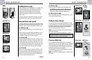
Auto Zoom Option ẅ ẋ
Highlight and select AUTO ZOOM to turn this feature on or off. When this
feature is on, the scale of the map adjusts automatically to show the entire
navigation currently in progress. When this feature is off, you adjust the
scale of the map manually using the ZOOM IN/OUT button.*
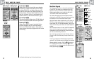
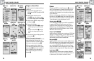
Stop Nav Option ẅ Ẍ
To stop the current navigation (GoTo, Route or Track), highlight and select
STOP NAV. Highlight and select YES to stop. Highlight and select NO to
make the current navigation continue.*
Defaults Option ẅ ẗẖ
Highlight and Select DEFAULTS to restore all original default Map page
settings. Highlight and select YES to restore original settings to Map
Orientation = North Up; Data field information = Speed; Map Details
shown = Names, Symbols, Waypoints, Cities/Towns, POI, Track, Route,
States; Auto Zoom = On. Highlight and select NO to maintain all current
settings.
*See “Using the Nav Data Page,” page 18, to learn about this feature.
Ẇ Panning
Map
ẅ Arrow Cursor
ẇ Page Button