16
EXPLORING THE PAGES : ALMANAC / ELEVATION
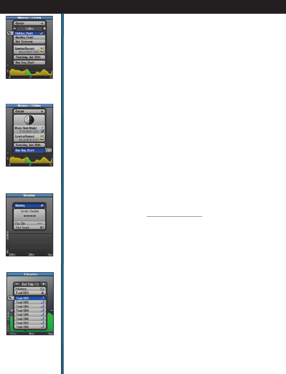
• Press the HOT button to open a ToolBox with three options (Fig. 18):
Fishing Chart-highlight this and press OK (a checkmark will appear) if you
want the animal activity level chart to be relevant for fish.
Hunting Chart-select and check this if you prefer the activity graph to indicated
mammal activity levels.
Set Timezone-select this and press OK to temporarily jump to the “Time”
options on the SET page (24 hr or AM/PM format, daylight savings, etc).
• To change the date (for example, if you want to see the solunar data and predicted
activity level for a day in the future), press the DOWN key to select the date box.
Now you can press the LEFT or RIGHT keys to go back or move ahead to a
different date. Or, press OK to get a popup one month calender, then use the 4-
way keypad to select a date and press OK. Pressing the “-” or “+” buttons when
the calender is displayed will change it to a past or future month.
• Press the DOWN key to select the “time period” box just above the graph,
then press either the OK button or RIGHT key to toggle between displaying an
animal/sh activity chart for One Day (Fig. 19) (just the currently displayed date
in the box above the time period) or for a One Month period of time. Note: e
green area that will appear shows the correction to the activity graph based on SoLunar
Edge Technology. is technology incorporates local pressure and temperature variations
that affect animal/fish behavior during that part of the day. A red line indicates the
selected day (One Month mode) or current time (One Day mode).
* For more information on patented Solunar Edge technology and Speedtech
Instruments products, visit www.Speedtech.com
e ELEVATION Page
e Elevation page uses data from the internal altimeter to display elevation
related information, including your current location’s elevation, the maximum
elevation reached on your trail, and the ascended total distance in feet or meters
(Fig. 20). You can view the elevation history for any of your previously stored
trails or the current one you’re on. A graph at the bottom of the screen shows how
your elevation has changed over time (up to 24 hours), or over distance traveled
on a trail. “A” and “B” markers may be placed on the graph to easily compare the
elevation differences between two points of distance or time on the trail. ese
markers are independent and each can be shown on the graph or not, removed, or
“Set to Now” to indicate your current position. Select the Elevation page on your
ONIX350 and explore the features and options:
Fig 21. Elevation:
Trip List
Fig 19. Almanac
Chart: Time
Period=1 Day
Fig 18. Almanac
Chart: HOT Button
Fig 20. Elevation
Page


