


30
iCN 530 | User Manual
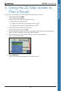
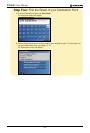
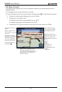
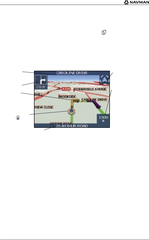
3D Map Screen
The 3D Map screen displays when a route is calculated, oriented to the travelling direction with an
adjustable horizon.
It is not possible to plan a route directly from this screen.
To view the 3D Map screen when a route has been calculated, press to cycle through the screens.
• To adjust the viewing angle, slide the stylus over the 3D Map.
North-oriented compass.
Tap to display the Satellite
Signal Strengths screen.
Additional information can
display here. Tap to scroll the
options. You must have a
route calculated to view these
options:
• Speed
• Time
• Heading
• Distance to Turn
• Distance to Go
• ETA (Estimated Time of
Arrival)
• Time to Go
Direction of the next turn.
Tap to hear next
instruction.
Your current position is
marked with .
Name of the next
location.
Displays either a description of the
information displaying in the bottom
right hand corner of the screen or your
current location. Tap to display the
Main Menu screen.
Your next turn is
highlighted in a different
colour from future turns.
The colour will depend on
the theme you are using.
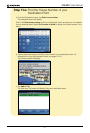
• To display the zoom options, tap .
• To display a smaller area in greater detail (zoom in), tap .
• To display a larger area in less detail (zoom out), tap .
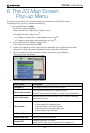
• To display the Go To Pop-up summary, use the stylus to tap and hold on the 3D Map.