


TRACKER 5505/5505i/5605 Installation and Operation Manual
44
NAVMAN
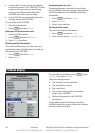
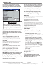
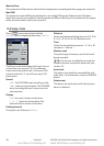
Setting map datum
1 In the Chart setup menu, select Map
datum.
2 Select the map datum for the paper chart
you are using.
3 If you select a datum other than WGS 84
the TRACKER asks if you want to apply the
NMEA datum offset (see below).
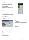
NMEA datum offset
If you select a map datum other than WGS 84,
the map datum offset can be applied to latitude
and longitude coordinates sent on the TRACKER
NMEA output:
Latitude and longitude coordinates
displayed on any NMEA repeater do not
match the coordinates on the TRACKER.
Latitude and longitude coordinates
broadcast on any NMEA VHF transmitter
will be the same as the coordinates on a
WGS 84 chart.
Latitude and longitude coordinates
displayed on any NMEA repeaters match
the coordinates on the TRACKER. However,
latitude and longitude coordinates
broadcast on any NMEA VHF transmitter
will be slightly offset from coordinates on a
WGS 84 chart.
Map shift
Some charts have consistent position errors. To
correct this, apply a map shift. After a map shift:
The positions of cartographic features (such
as land, rocks, buoys and depth contours)
move on the TRACKER chart display to
where they should be.
The positions of the boat, waypoints, tracks,
and lines of latitude and longitude on the
TRACKER chart display remain unchanged.
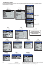
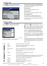
Applying a map shift
1 Move the boat to a known point on the
chart, for example a marina berth.
2 In the Chart setup menu, select Map
shift.
3 Move the cursor to the position on the chart
where the boat actually is.
4 Press and select Set.
5 Press to set the new map shift. The
boat will now be displayed at its actual
location.
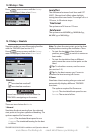
Clearing the map shift
Clearing the map shift removes any map shift
from the cartographic features on the TRACKER
chart display.
1 In the Chart setup menu, select Map
shift.
2 Press and select Clear.
3 Press .
CAUTION
!
!
CAUTION
DANGER
WARNING
When you change to a chart with a
different datum, change the TRACKER map
datum again.
CAUTION
!
!
CAUTION
DANGER
WARNING
Map shift is for eliminating minor offsets.
It should not be used if the correct datum
is available. Use map shift with caution:
incorrect application will cause incorrect
boat positions.
www.Busse-Yachtshop.de email: info@busse-yachtshop.de