


TRACKER 5505/5505i/5605 Installation and Operation Manual
22
NAVMAN
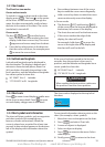
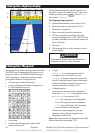
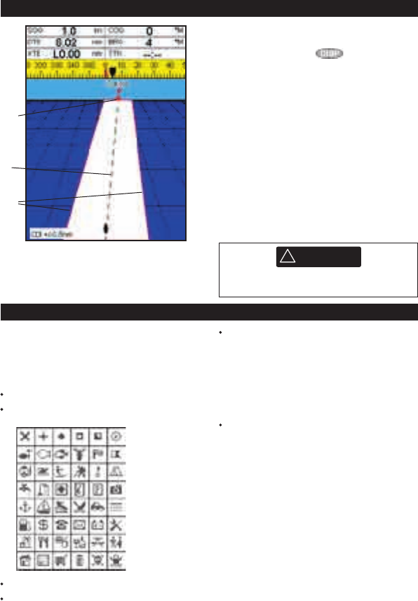
4 Navigation: Highway display
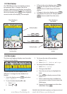
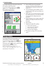
The highway display has a bird’s eye view of
the boat’s course to a destination. To go to the
Highway display, press , select Other,
then select Highway.
The highway display shows:
A Optional data header (see section 2-8-3)
B Optional compass (see section 2-8-4)
C Destination waypoint
D Boat’s plotted course to destination
E CDI lines, parallel to the boat’s plotted
course (see Appendix C, CDI). The CDI lines
are like a highway over the water where the
boat will move.
F CDI scale
G The boat position is at the bottom, centre
of the display.
A
C
D
B
E
G
F
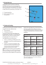
5 Navigation: Waypoints
A waypoint is a position that you can set on the
TRACKER chart for example a fishing spot or a
point on a route. The TRACKER can have up to
3000 waypoints. A waypoint can be created,
changed or deleted. A waypoint has:
A name (up to eight characters).
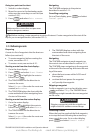
An icon showing what kind of waypoint it
is. The available icons are:
A position.
A colour for the waypoint symbol and
name on the chart.
A type:
Normal: A normal waypoint can be
navigated to or included in a route.
Danger: A danger waypoint is a point to
avoid. If the boat comes within the danger
radius of a danger waypoint the unit can
sound an alarm (see section 14-7).
A display option:
Controls how the waypoint is displayed
when the Waypoints setup option is set
to Selected (see section 14-2):
Off: The waypoint is not displayed.
Icon: The waypoint icon is displayed.
I+N (Icon and Name): The waypoint
icon and name are displayed.
If there are many waypoints, use this
feature to select which waypoints are
displayed on the chart.
Note: The other choices for Waypoints are Hide
all and Show all (see section 14-2).
CAUTION
!
!
CAUTION
DANGER
WARNING
The highway display does not show land,
dangerous waters or chart symbols.
www.Busse-Yachtshop.de email: info@busse-yachtshop.de