


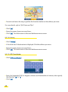

• In Navigation mode, POIs are displayed in real time. The icons showing the position of the
POIs are thus displayed on the map and move with it. If you select a lot of POI categories to
display or if you clicked "Select all", the information on the screen may update more
slowly.
• When the selected "Map language" is different from the "Interface language", town
names, street names, etc., must be searched for in the "Map language".
• To prolong battery life, we advise you to leave your ViaMichelin Navigation X-930 system
connected to a power source or to recharge it after use.
• The brightness level affects power consumption on the ViaMichelin Navigation 930.
Laboratory tests have achieved battery life of 5 hours with brightness reduced by half, as
compared to approximately 3 hours with maximum brightness.
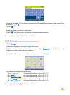
• To delete a letter, click the left arrow at the bottom right of the screen.
• To access the number pad, click the [123] box;
• To return to the alphanumeric keyboard, click the [abc] box.
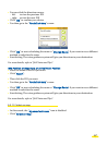
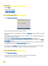
• On the "Route Summary" screen, you can use the right-hand buttons to save the departure
point and the arrival point and to change the navigation settings.
• During Navigation, only the "fastest method" of route calculation is used.
• The route calculated is displayed on the map in the form of a green line highlighting the
roads taken.
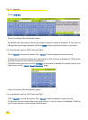
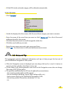
• You can use the direction arrows to view the whole POI (Points Of Interest) list.
• If you start the search without entering the town name by clicking "Display all", the system
will list the first 50 towns.
• When searching for a POI in a town, the system presents the POIs in descending order of
distance from the town centre.
• If you start the search without entering a POI name, the system will display a list of the
POIs it knows, or with the arrival point.
• The POIs are presented in descending order of distance from the position established by the
GPS at the time of the search.
• Click the (-) and (+) buttons in the top bar to zoom one level out or in on the map.
• Click in the space on the top bar to zoom several levels in or out on the map.
• Click the screen and move the map in the direction you want, to display the area you are
interested in.
• If the coordinates show a point a long way from a road, the message “The place selected
must be less than 25km from a road” appears. In this case, click "OK" to return to the
longitude input screen.
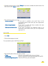
• In the settings screens, selecting an option switches it on.
• In the settings screens, you can click the criterion to bring up a list of available criteria.
Then click the one you want to select.
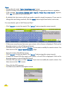
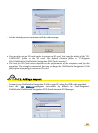
• Battery levels are shown using 3 fill levels (almost empty, half-full, full) and 3 colours
(Green, Orange, Red). The battery levels are displayed as follows:
Level between 50% and 100%: full / green
Level between 35% and 50%: half-full / orange
Level below 35%: almost empty / red
62