


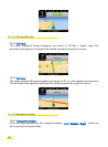
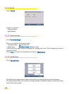
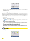
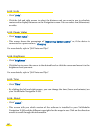

• This function shows the GPS satellite signal reception and gives the position coordinates
evaluated by the GPS.
For more details, refer to "§6.6 Notes and Tips".
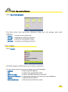
When using the ViaMichelin Navigation X-930 for the first time, we recommend you do so
in an open space in order to ensure the best possible satellite reception. Activating the GPS
system for the first time can take several minutes, depending on the surroundings and the
quality of the GPS signals.
• On this screen:
The green "V" means that the GPS is on.
- "NO FIX/FIX: 2D/FIX: 3D" indicates better signal reception, and therefore more
accurate positioning.
- "SAT" indicates the number of satellites used to calculate your position.
the vertical bars show the satellites detected:
- grey the device is receiving satellite signals but cannot use them to establish your position.
- green the device is using the satellite signals to calculate your position.
- The numbers under the vertical bars give the satellite number.
- coordinates: longitude and latitude calculated by the system.
- direction arrow: shows the direction of travel between 2 position calculations by the GPS.
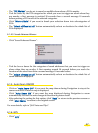
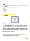
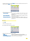
6.2. Map
• Click "Map".
48