


53
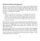
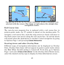
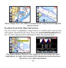
Information for almost any on-screen symbol can be accessed as long as
it can be highlighted with the cursor. The Tidal Current Information
screen displays daily tidal current data for specific stations on this date
at the present time. The graph at the top of the screen is an approxi-
mate view of the flood and ebb pattern for the day, from midnight
(MN), to noon (NN) to midnight (MN). Slack water, the period of little
or no current, is represented by the Slack Water Line (SWL). The flood
appears above the SWL and the ebb appears below the SWL. Look up
tidal current data for other dates by changing the month, day and year
selection boxes at the bottom of the Tidal Current Information screen.
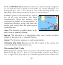
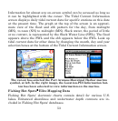
The cursor has selected the Port Aransas Municipal Harbor marina
symbol, at left. In the right image, the Location-POI Information but-
ton has been selected to view information on the marina.
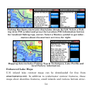
Fishing Hot Spots
®
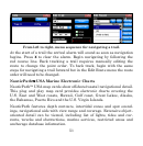
Elite Mapping Data
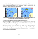
Fishing Hot Spots' electronic charts contain detail for various U.S.
lakes. Enhanced shorelines and underwater depth contours are in-
cluded in Fishing Hot Spots' databases.