


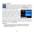

49
Uncheck
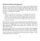
HIDE WHEN INVALID and close the menus. Some overlay categories
do not work the same in point-to-point mode, but several data types can
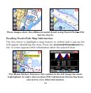
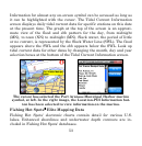
help guide you. One of the easiest to use is the Steering Arrow. The
Steering Arrow shows which way to steer to a destination.
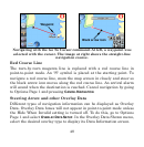
It always points to the destination, regard-
less of the map orientation. The arrow
automatically shows the distance from
your current position to the destination. In
addition to the Steer arrow, the most com-
monly used overlay data for point-to-point
navigation are:
Track: The direction traveled; shown in de-
grees, true or magnetic format.
Bearing: The direction to a destination from your current position;
shown in degrees, true or magnetic format.
Course: The direction traveled to reach a destination.
Off Course (Pos Error): Distance to the left or right of the course line
when not directly on the course line.
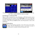
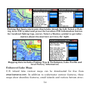
Navigating With Trails
Displaying and editing trails is discussed under the topics Categories
Drawn and My Trails. A trail is a history of the path you have taken
and is represented by a dotted line extending from the back of the black
Steerin
g
Arrow