


67
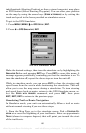
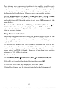
3. To turn off a Navionics chart, From the Map Page, press
MENU|↓ to
MAP DATA|ENT|↓ to MAP CHOICE|ENT. Use ↑ or ↓ to select LOWRANCE, then
press
ENT|EXIT|EXIT.
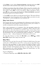
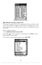
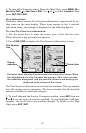
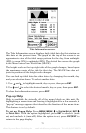
Port Information
Navionics charts contain Port Services information, represented by an-
chor icons on the map display. These icons appear at the 2 nautical
mile zoom range. An example is displayed in the following figures.
To view Port Services information:
1. Use the arrow keys to move the cursor over a Port Services icon.
When selected, a pop-up name box appears.
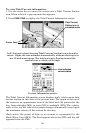
2. Press
FIND|FIND to display the Port Services Information screen.
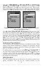
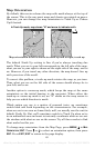
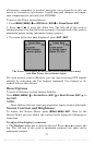
Navionics chart showing Port Services icon selected by cursor. When
first highlighted, the Pop-Up name box appears. After a few seconds,
the name box disappears, and the position, distance and bearing are
displayed at the bottom of the screen.
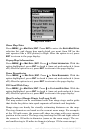
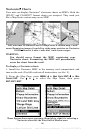
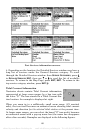
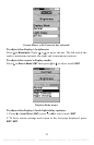
The Port Services information screen has two windows. The top window
lists the various service categories. The lower window lists the detailed
services available in each basic category.
3. To scroll through the Service Categories window: press
ENT then use
↑ or ↓ to see the types of services available. As you highlight a different
category, the list in the lower window changes. To return to the Map
Page, press
EXIT|EXIT.
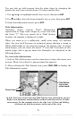
Port Services
icon
Pop-up
name box
Cursor lines
offered by www.Busse-Yachtshop.de email: info@busse-yachtshop.de Tel: +49 (0)4347 908234