


62
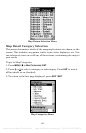
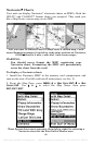
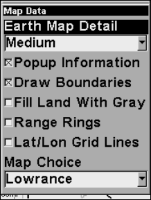
Map Data Menu.
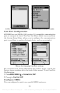
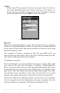
Show Map Data
Press
MENU|↓ to MAP DATA|ENT. Press ENT to enter the EARTH MAP DETAIL
selection list, and choose how much detail you want, from Off (so the
unit operates like a GPS plotter) to High. After the option is set, press
EXIT to return to the page display.
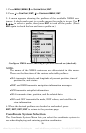
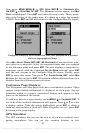
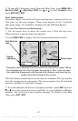
Popup Map Information
Press
MENU|↓ to MAP DATA|ENT. Press ↓ to POPUP INFORMATION. With the
option highlighted, press
ENT to check it (turn on) and uncheck it (turn
off.) After the option is set, press
EXIT to return to the page display.
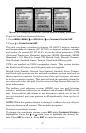
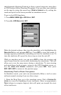
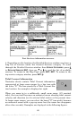
Draw Boundaries
Press
MENU|↓ to MAP DATA|ENT. Press ↓ to DRAW BOUNDARIES. With the
option highlighted, press
ENT to check it (turn on) and uncheck it (turn
off.) After the option is set, press
EXIT to return to the page display.
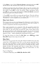
Fill Land With Gray
Press
MENU|↓ to MAP DATA|ENT. Press ↓ to FILL LAND WITH GRAY. With the
option highlighted, press
ENT to check it (turn on) and uncheck it (turn
off.) After the option is set, press
EXIT to return to the page display.
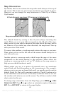
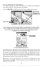
Map Overlays (Range Rings; Lat/Long Grid)
The map screen can be customized with four range rings and/or grids
that divide the plotter into equal segments of latitude and longitude.
Range rings are handy for visually estimating distances on the map.
The ring diameters are based on the current zoom range. For example:
at the 100 mile zoom, the screen will show two rings with your current
position in the center. The large ring touching the left and right sides of
the screen is 100 miles in diameter (same as the zoom range). The sec-
ond smaller ring is 50 miles in diameter (always 1/2 the zoom range).
offered by www.Busse-Yachtshop.de email: info@busse-yachtshop.de Tel: +49 (0)4347 908234