


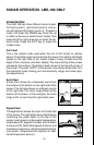
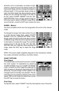

63
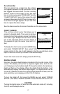
while the unit is in automatic, as shown at right.
However, depending upon the bottom depth and
the current range, you can change the range to a
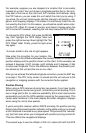
different depth. In the example screen shown at
right, the bottom depth has descended to a point
where you can change the range to XX feet. To
do this, select “CHART RANGE” from the “SO-
NAR OPTIONS” menu. Simply press the right or
left arrow keys to select a different range. When
you’re finished , press the EXIT key to erase the menu.
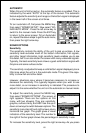
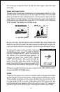
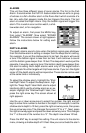
RANGE - Manual
You have complete control over the range when the unit is in the manual
mode.
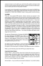
To change the range, first make certain the unit
is in the manual mode. Next, select “CHART
RANGE” from the "SONAR OPTIONS" menu.
Simply press the right or left arrow keys to select
a different range. Press the left or right arrow keys
to decrease or increase the range. The available
ranges are 0-10, 20, 30, 40, 60, 100, 150, 200,
300, 500, 800, and 1000 feet. After selecting the
range, press the EXIT key to erase the range
menu.
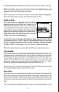
NOTE: The sonar’s depth capability depends on the transducer installa-
tion, water and bottom conditions, and other factors.
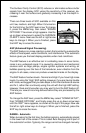
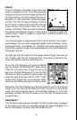
CHART OPTIONS
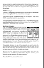
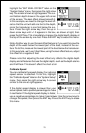
Chart Speed
The rate echoes scroll across the screen is called
the chart speed. It’s adjustable by selecting
“CHART SPEED” from the "CHART OPTIONS"
menu. Increase the chart speed by pressing the
right arrow key or decrease it by pressing the left
arrow key. The percentage of chart speed in use
changes as the arrow keys are pressed. The bar
chart also gives a graphical indication of the chart
speed. After you’ve made the adjustment, press
the EXIT key to erase the menu.
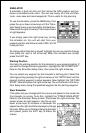
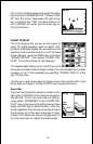
Chart Stop
To stop the chart, select “CHART” from the chart options menu. Press the