


Introduction
Apollo GX50/60/65 Installation Manual
3
FEATURES
The GPS navigation features for the GX50 GPS and GX60/65 GPS/Comm include:
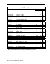
• High resolution, daylight readable graphics display
• Automatic display intensity
• Back-lit buttons
• Simple “Direct-To” navigation
• Datacard database for easy user update and replacement
• Nearest waypoint and airspace search (includes airports, VORs, LocDMEs, NDBs,
intersections, and user waypoints)
• Remote waypoint search
• Navigation displays -
− Lat/Lon to 0.01 minute
− Bearing and distance to waypoint
− Ground speed and track angle
− Track angle error
− Desired track and distance between waypoints
− Cross track error with numeric and graphic CDI
− Display of the “TO” waypoint ident
− ETE and ETA to the “TO” and destination waypoints
− Altitude (from altitude encoder/converter input)
− Minimum safe altitude and en route safe altitude information
• Map Displays -
− Full screen map with bearing, distance to waypoint, and zoom level
− Split screen map with distance, speed, bearing, track, crosstrack error, To
waypoint, and zoom level
− Split screen with nav data and comm frequency display (GX60/65 only)
− Smart key, 1 button map declutter, Tri-state
− On map waypoint selection for information, direct-to nomination
− Track up, desired track up, and magnetic north up options
− Runway diagrams and runway names displayed
− 5nm ATC rings around airports with control towers
− Airspaces displayed by sector or outer boundary
− Airspace display controllable by type
− Approach preview page (GX50/60 only)
− Route line displayed
• Automatic waypoint sequencing
• Vectors to final input (GX50/60 only)
• DME arc assist
• Built-in simulator for trip planning and training
• User definable navigation pages with auto sequencing
• 30 flight plans of 20 legs each
• 500 user waypoints created by lat/lon or by radial/distance from a reference waypoint
• Real time clock (time and date) in UTC
• Countdown timer