


337
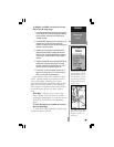
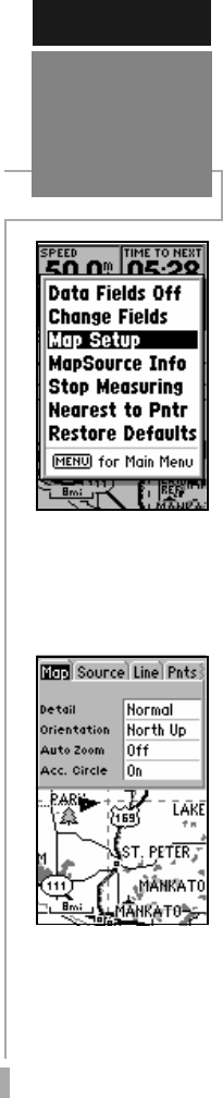
Map Setup — allows you to configure the
map display to your preferences, including
map detail, map orientation, automatic
zoom, lat/lon grid, track and route lines, exits
and waypoint names. The map setup option
uses a ‘file tab’ feature, making it easier to
organize the various settings and easier for
you to use. The following section lists the file
tabs and the settings available under each
tab.
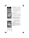
Map - Detail, Orientation, AutoZoom,
Accuracy Circle.
Source - Built-in Base Map, MapSource Files
Line - Track Log, Active Route Lines, Roads/
Street Labels
Pnts -All Waypoints and Text, Active Route
Wpts, Common Exits and Special Exits
City - Large/Medium/Small Cities, Small
Towns, Text
Geo
- Geo Points, Rivers, Lakes, Park Areas
Topo- Major Contour, Med. Contour, Min.
Contour, Land Cover
Other - Marine Navaids, Lat/Lon Grid, Metro
Areas, Railroads
NOTE: Large cities are those with approximate
populations greater than 200,000. Medium cities
are those greater than 50,000 and Small cities
are those greater than 5,000. Small towns have
populations under 5,000 or the population is
unknown.
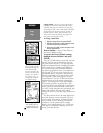
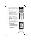
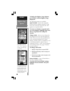
To change a map setup feature:
1. Highlight ‘Map Setup’ and press ENTER.
2. To set the desired map detail, select the
‘Map’ tab (if not already selected). Scroll
down (using the rocker keypad) to highlight
the ‘Detail’ field and press ENTER. Select the
desired detail level - More, Normal, Less,
Least and press ENTER
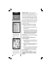
NOTE: The ‘Detail’ setting applies to any map
feature set to “Auto”. Those features for which you
have specified a maximum scale, or turned “Off”, are
unaffected by the detail setting.
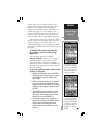
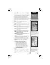
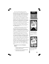
REFERENCE
Map Page
Options
‘Map Setup’ allows you
to change map orienta-
tion, background map
detail, text, size etc.
The map settings are or-
ganized in a series of ‘file
tabs’. Use the rocker key-
pad to select the desired
tab, and to select the de-
sired settings.