


30
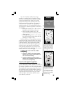
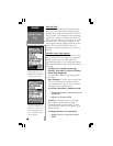
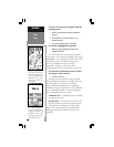
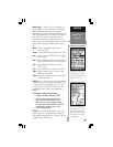
Change Fields— allows you to choose the data
displayed on the six user-selectable data fields.
Available data types are: Altitude, Average (Avg)
Speed, Battery (Bat) Timer, Max Speed, Odometer,
Speed, Sunrise (at present position), Sunset (at
present position), Track, Trip Odometer, Trip
Timer, User Timer and Voltage. See page vii for
descriptions of navigation terms.
To change a data field:
1. Highlight ‘Change Fields’ and press ENTER.
2. Highlight the data field you wish to change (using
the rocker keypad) and press ENTER.
3. Select the type of data you want to appear on this
field and press ENTER.
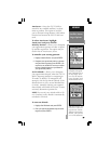
Restore Defaults— resets all data fields to
the factory default settings.
To restore the factory default settings,
highlight ‘Restore Defaults’ and press
ENTER.
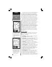
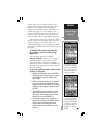
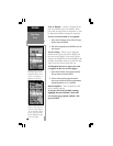
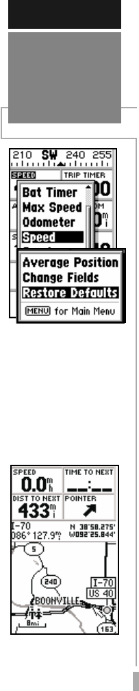
The GPS 12 MAP features a powerful real-time
moving map that can do much more than just
plot your course and route. The Map Page also
displays background detail, including geographic
names, lakes, rivers, coastlines and highways.
You can load maps with detailed information
for specific geographical areas. (See MapSource
Info on page 36) An on-screen cursor lets you
pan ahead to nearby waypoints, determine the
distance and bearing to any map position, mark
new waypoints while you navigate or retrieve
exit information. The GPS 12 MAP also features
dedicated zoom keys for instant zooming (see
page 2). The map portion of the page displays
your present position as a pointer icon, with
your track and/or route displayed as small points
on the screen (an electronic bread crumb trail, if
you will). Nearby waypoints are represented with
names and symbols. You may select which
features are shown via the Map Page Options (see
pg. 35).
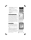
The data window above the map displays the
time and distance to next waypoint, plus your
current speed (all defaults). A bearing pointer
lets you know if you’re heading toward your
destination. (If the pointer points straight
ahead, you’re heading directly to it.) Each data
field may be configured to display any one of
twenty-four data options.
REFERENCE
Map
Page
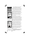
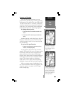
‘Change Fields’ allows
you to custom tailor the
information that appears
on the Position Page.
‘Restore Defaults’ will
override any data field
changes you’ve made to
the Position Page, re-
verting back to the fac-
tory default settings.
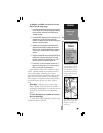
The Map page displays a
map, including, lakes, riv-
ers, highways, interstate
highway exits and towns.