


17
The GPS 12 MAP’s Map Page combines
digital charting with a number of user-selectable
features. Before we select our destination and
begin navigating toward it, let’s take a look at
some of those features.
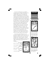
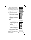
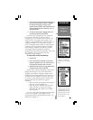
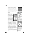
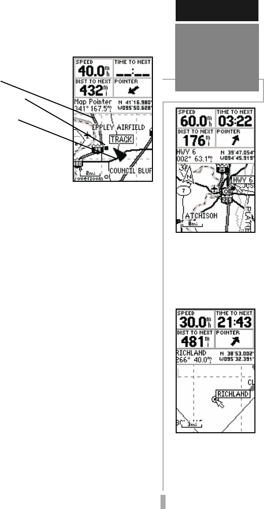
The map display shows
your present position using
a pointer icon in the center
of the screen. The Map
Page also shows any nearby lakes, rivers,
highways and towns. Use the zoom keys (IN
and OUT) to adjust the map to the desired
scale. The current scale is indicated in the
lower-left corner.
To change the map scale:
1. Press the IN zoom key to select a smaller scale
and display a smaller geographic area.
2. Press the OUT zoom key to select a larger scale
and display a larger geographic area.
The map can be oriented with the top of the
page always pointing north (‘North Up’),
oriented along your desired course (‘Course
Up’), or it can automatically rotate to keep your
current direction of travel at the top of the
screen (‘Track Up’).
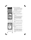
Nearby waypoints are depicted on the map
with any one of over 50 different symbols, with
the waypoint name displayed directly above the
symbol. Let’s create a waypoint directly on the
map display to see how that process works,
then we’ll navigate to this new waypoint.
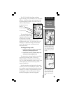
SIMULATOR TOUR
Using the
Map Page
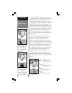
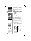
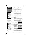
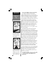
In the ‘TrackUp’ orien-
tation, the map is auto-
matically rotated to keep
your current direction of
travel at the top of the
display.
Use the IN/OUT zoom
keys to change the map
scale. The current scale
appears in the lower-left
corner of the map dis-
play.
Background Roads &
Railways
Nearby Waypoints
Present Position