


65
GPSmap 76CS
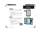
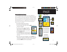
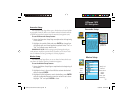
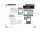
Geocache Setup
The Geocache Setup Page allows you to find and record items hidden
at geographic locations. Refer to the Garmin website for details and how
to download geocache locations from the internet (www.garmin.com).
To use the Geocache Setup feature:
1. Access the Geocache Setup Page as explained at the beginning
of this section.
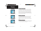
2. Highlight the symbols fi elds and press ENTER to change from
the default open and closed geocache symbols. Select “Yes” or
“No” for Calendar entry when found.
IMPORTANT NOTE: Before setting up and placing physical geo-
cache stations on public or private land, be certain you are not in viola-
tion of ordinances or laws governing use of these properties.
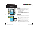
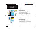
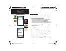
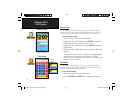
Marine Setup
The Marine Setup Page allows you to set values for limits which acti-
vate alarms for features specific to maritime navigation.
To use the Marine Setup feature:
1. Access the Marine Setup Page as explained at the beginning of
this section.
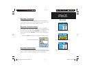
2. Highlight the box in front of each fi eld to activate the desired
alarm and press ENTER.
3. Highlight the fi eld adjacent to each checked box, press ENTER
and use the Number Keypad to enter the value for each alarm.
Highlight “OK” and press ENTER to close.
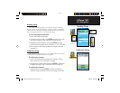
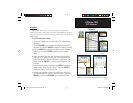
Speed
Filter
Options
GPS Navigation
Geocache Setup
Marine Setup
Waypoint
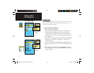
Symbols List
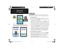
“Deep” and
“Shallow”
water alarms
require
NMEA
sonar input
interfacing.
GPSmap 76CS Owner's Guide copy.indd 65GPSmap 76CS Owner's Guide copy.indd 65 10/8/2004 8:28:24 AM10/8/2004 8:28:24 AM