


22
GPSmap 76CS
GPS Navigation
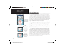
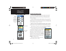
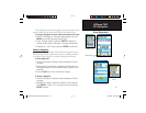
The Altimeter Page
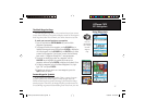
Zoom Ranges
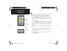
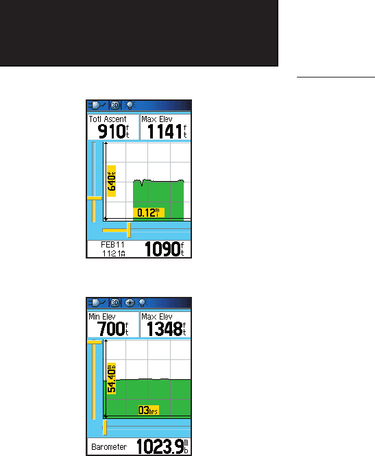
You can set the Zoom Ranges for elevation, distance, or time when
you display the “View Elevation Plot”. Ranges for vertical distance are dis-
played as you press the Up and Down ROCKER keys. Ranges for linear
distance are displayed as you press the Left and Right ROCKER keys.
Ranges for time are displayed for a time plot when you press the Left and
Right ROCKER keys.
Ranges for “View Pressure Plot” pressure values are displayed when
you press the Up and Down ROCKER keys. Values for time and distance
are displayed in the same manner as for elevation plots.
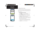
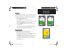
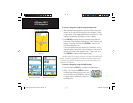
To adjust zoom ranges:
1. Select the type of plot you want to display and use the
ROCKER key to highlight “Zoom Ranges” from the Options
Menu.
2. Press ENTER to display the Zoom Ranges Page. Move the
ROCKER key Up or Down to adjust the vertical distance or
pressure and Left or Right to adjust either the time or distance.
Press ENTER to return to the Plot Page.
Moving the Up or Down ROCKER key with a plot displayed will
switch to the Zoom Range mode.
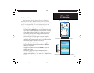
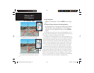
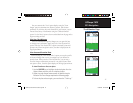
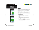
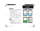
Zoom Ranges for
Elevation over Distance Plot
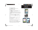
Zoom Ranges for
Pressure over Time Plot
GPSmap 76CS Owner's Guide copy.indd 22GPSmap 76CS Owner's Guide copy.indd 22 10/8/2004 8:27:31 AM10/8/2004 8:27:31 AM