


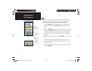
20
GPSmap 76CS
GPS Navigation
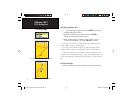
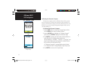
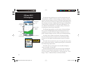
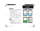
The Altimeter Page
The Altimeter Page provides the user with the current elevation, rate
of ascent/descent, a profi le of elevation changes over distance or time, or
a profi le of pressure changes over time. The Altimeter Page Options Menu
allows you to select from a variety of display options such as plotting over
time, plotting over distance, displaying the zoom ranges of measurement,
viewing elevation or pressure points, and resetting data displays. Two
user selectable data fi elds allow you to display a variety of current and
recorded pressure and elevation related data.
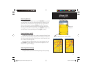
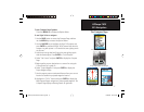
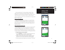
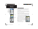
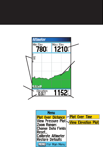
The Altimeter Page provides you with a variety of elevation informa-
tion: A Status Field that displays current elevation and current rate of
ascent/descent, a profi le of elevation changes over distance or time, a
profi le of pressure changes over time, and two user selectable data fi elds.
The Status Field is located at the bottom of the page and displays
the current elevation and your current rate of ascent or descent when
moving. It can also display the ambient pressure and time of measure-
ment.
The Profi le Field is located in the center of the page and can be confi g-
ured to display either elevation or ambient pressure plots as selected from
the Altimeter Page Options Menu.
Data Fields at the top of the page are user selectable and display a
variety of recorded or current data.
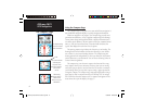
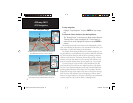
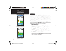
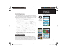
The Page Options Menu allows you to select the type of information
and how it is to be displayed. Page Options include: “Plot Over Time,”
“Plot Over Distance,” “View Elevation Plot,” “View Pressure Plot,” “Zoom
Ranges,” “Reset,” “Calibrate Altimeter” and “Restore Defaults.”
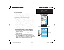
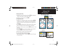
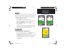
Altimeter Page
Selectable Data
Fields
Elevation Profi le
Elevation Status
Field
Options Menu
Current Elevation
Rate of
Ascent/Descent
Plot over
Distance
Range Grid
Measurement
Scale
GPSmap 76CS Owner's Guide copy.indd 20GPSmap 76CS Owner's Guide copy.indd 20 10/8/2004 8:27:29 AM10/8/2004 8:27:29 AM