


41
GPSmap 76CS
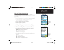
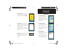
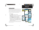
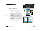
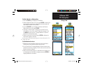
To find a Wreck or Obstruction
1. Press the FIND key to display the Find Menu.
2. Select the Marine Points icon, then press ENTER to display the
sub-icon(s) for marine items supported by the basemap and
downloaded detailed marine charts.
3. Use the ROCKER key to highlight and select the Wrecks/
Obstructions icon, then press ENTER.
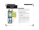
4. If you get a “None Found” message, you are too far from
the coastline or out of the area of map data coverage. Press
the MENU key and use the “Change Reference” option as
explained on the previous page.
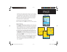
5. Select an item from the list and press ENTER to display the
information page for that item.
At the bottom of the Information Page are on-screen buttons for “Go
To,” “Map” and “Save.”
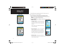
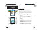
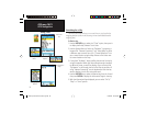
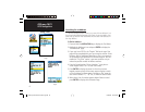
To find Marine Services
1. Follow the same procedure as above to access the Marine
Points Menu, then select the Marine Services icon.
2. If the “None Found” message displays, follow the same steps
explained previously to display a list of marine services near the
location you have selected.
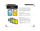
3. When the information page for a selected service displays, you
can highlight each information category and press ENTER to
display additional information.
GPS Navigation
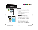
Using Find
Wrecks/Obstructions List
Marine Services List
Detailed Information
Detailed Information
GPSmap 76CS Owner's Guide copy.indd 41GPSmap 76CS Owner's Guide copy.indd 41 10/8/2004 8:27:54 AM10/8/2004 8:27:54 AM