


33
Reference
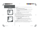
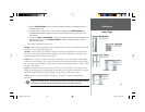
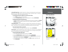
Map Page Options
• ALTITUDE – Altitude above/below MSL (Mean Sea Level)
• BEARING – Compass direction from your position to destination
• COURSE – Course over ground
• DEPTH – Depth below transducer
• DIST TO DEST – Distance to fi nal waypoint
• DIST TO NEXT – Distance to next waypoint
• ETA AT DEST – Estimated Time of Arrival to fi nal waypoint
• ETA AT NEXT – Estimated Time of Arrival to next waypoint
• MAX SPEED – Fastest speed the unit has traveled
• MOV AVG SPEED – Average moving speed
• MOV TRIP TIMER – Time unit has been moving for a trip
• OFF COURSE – Distance from desired track
• POINTER – Arrow points to your destination
• SPEED – Speed over ground/water
• TIME OF DAY – Current time
• TIME TO DEST – Time to fi nal waypoint at current speed and course
• TIME TO NEXT – Time to next waypoint at current speed and course
• TO COURSE – Distance to desired track
• TRACK – Current compass heading
• TRIP ODOM – Trip Odometer
• TTL AVG SPEED – Total average speed
• TTL TRIP TIMER – Total travel time of trip, stopped and moving
• TURN – Turn angle to waypoint
• VMG – Velocity Made Good to destination
• VOLTAGE — Input voltage as measured by the unit
• WATER SPEED – Speed through the water (if equipped with optional speed transducer/sensor)
• WATER TEMP – Water temperature (if equipped with optional speed transducer/sensor)
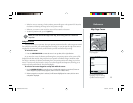
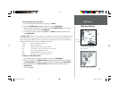
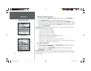
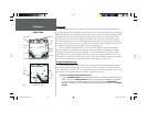
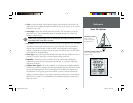
To change a data fi eld:
1. From the Map Page’s menu options list, use the ARROW KEYPAD to highlight the ‘Change Data
Fields’ option and press ENTER/MARK.
2. Move the fi eld highlight to the data fi eld you want to change and press ENTER/MARK.
3. Move UP or DOWN on the ARROW KEYPAD to highlight the data you want to display, and press
ENTER/MARK. To exit, press QUIT.
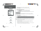
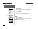
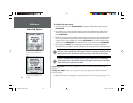
Choose the type of data you wish to
display.
168 Manual Part 1.indd 01/09/01, 10:41 AM33