


31
Reference
Map Page Options
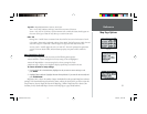
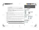
Topo Tab— Major/Medium/Minor Contours, Land Cover
Text— None, Small, Medium, and Large: controls the screen size of the name.
Zoom— Auto, Off, 120 ft.-800 mi.: sets the maximum scale at which the feature should appear on
the screen. Some types of data will only show up to certain zoom scales.
Other Tab
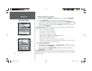
Bearing Line— On/Off: draws an extension from the end of the boat icon in the direction of travel.
Color Mode— Water Mode, Land Mode: when in “Water Mode”, land will appear as a dark color and
water will be light. In “Land Mode”, land will appear as a light color and water will be dark.
Accuracy Circle— On/Off: toggles the circle “On” and “Off”. The circle represents the approximate
accuracy of the unit based on EPE, DOP, and basemap quality. You position will be within the
circle.
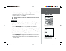
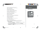
Map Setup Menu Options
From the map confi guration tab you can access the following menu options:
• Restore Defaults— restores settings back to factory settings for the tab highlighted.
• Restore All Map Defaults— restores settings back to factory settings for all tabs.
• MapSource Info— allows you to display/not display optional map sets loaded in the unit.
To restore defaults for map settings:
1. From the ‘Map’ tab in the Main Menu, highlight the tab you want to restore settings to and
press MENU.
2. Highlight ‘Restore Defaults’ (highlight ‘Restore All Map Defaults’ if you want all tabs restored) and
press ENTER/MARK.
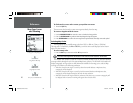
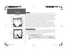
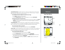
MapSource Info— shows the number of maps downloaded from the optional MapSource software
package. Each downloaded map is described by name, and may be deselected if you wish to retain the
map in memory, but not display the data on the Map Page. (When a MapSource fi le is selected, the
boundary for any downloaded map is shown on the Map Page as a gray shaded outline.)
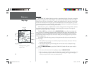
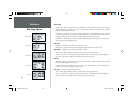
Other Tab
Map Setup Menu Options
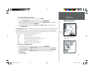
Topo Tab
168 Manual Part 1.indd 01/09/01, 10:41 AM31