


13
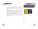
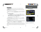
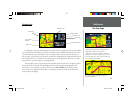
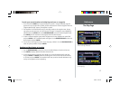
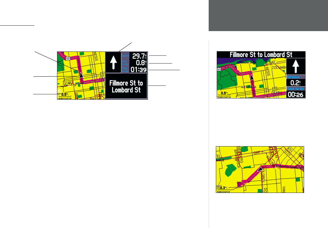
The Map Page
The Map Page is the main operating page of the StreetPilot III. It graphically shows you map details,
your current location, and marks your route to a destination with a magenta colored route line. It tells
you what direction to go or the direction you are traveling. It tells you your speed, the distance you
have traveled, or the distance to the next turn, and the time remaining before reaching the next turn. If
the StreetPilot III has yet to calculate your location, there is a fl ashing question mark over the vehicle
pointer and the status text displays, ‘Acquiring Satellites’.
The map display shows your present position and direction of movement as a triangular ‘Position
Icon’ in the center of the map. The map display also shows the map scale and geographic details
such as lakes, rivers, highways, and towns. You can use the IN and OUT keys to change the map
scale to show more map area with less detail, or less map area with more detail. Press and hold to
zoom the map scale rapidly.
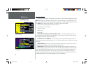
Reference
The Map Page
Map Scale
Vehicle Speed
Route Line
Your Current
Position
Direction to Go
Distance to Go
Time to Go
Driving Instructions
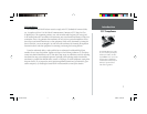
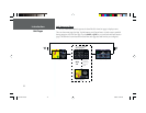
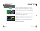
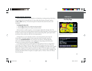
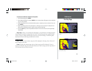
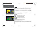
The map can be displayed in a ‘square’ or
‘wide’ confi guration for custom viewing. The square
confi guration is shown to the left, the wide
confi guration is shown above. Both show Navigation
Information. For maximum map display, you can select
‘Full Screen Map’. This section of the manual discusses
how to select between the displays.
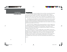
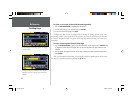
The ‘Full Screen Map’ confi guration showing no
Navigation Information.
OM REV B.indd 6/28/01, 9:42 AM13