


18
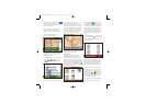
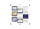
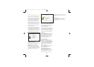
one another: for example, by adding the direction
of the traffic and house numbers. One-way roads
are distinguished from main roads and sand paths.
Where do the railway tracks and the waterways
lie? In which council is this part of the road
located and to which council does the other part
belong? In short, each section of road in your
navigation system is provided with detailed data
which is stored in an enormous digital databank.
The Living Map
The necessary data is not available from a single
agency, therefore companies such as Tele Atlas
carry out the research themselves. For instance,
by collecting data from town and county councils,
and from central government. But also by doing
the field-work themselves.
Tele Atlas employs about 1,800 people world-wide,
most of whom are working daily on registering any
and all changes, and reproducing them in maps
which can be used in navigation systems. At pres-
ent, Tele Atlas is active in about 25 countries spread
throughout three continents, and is continually
working to extend the area it covers.
The Qualitative Map
The maps are kept up to date continuously and are
published a number of times per year. As soon as
a map is available, it is combined with the route-
planner and navigation functions of the system
developer. This integration determines the quality
of the final product which provides you, as the
traveller, with the information you need on the way
to your destination.
The Tele Atlas Map: A Reference
Organizations such as the police, fire brigade,
utility companies and publishers of digital telephone
books throughout the world depend not only on the
well-known navigation systems, but also on the
quality of these maps.
So that they can finally achieve their goal, just as
you can reach your destination...
The information in this document is subject to
change without notice. TomTom B.V. shall not be
liable for technical or editorial errors or omissions
contained herein; not for incidental or consequen-
tial damages resulting from the performance or
use of this material. This document contains
information protected by copyright. No part of
this document may be photocopied or reproduced
in any form without prior written consent from
TomTom B.V.
Copyright statements
© 2004 TomTom B.V. Data source © 2004 Tele Atlas
N.V. Based upon Ordnance Survey data with
permission of Her Majesty’s Stationery Office ©
Crown Copyright 2004. The Ordnance Survey data
contained in this product is Crown Copyright
material and Ordnance Survey is the copyright
owner of the Ordnance Survey Data. Data source
© 2004 Tele Atlas N.V. Ordnance Survey of
Northern Ireland. TomTom and the TomTom logo
are registered trademarks of TomTom BV, The
Netherlands. All other trademarks are the property
of their respective owners.
Appendix B:
Tele Atlas gets you there…
‘…turn right after 300 meters and keep driving on
the right…’
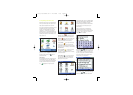
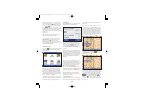
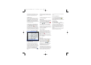
The Intelligent Map
The road map is an essential part of your navigation
system. Do you want to find the fastest or shortest
route? Or use the toll roads? What is the current
traffic situation? How do you get the right instructions
at the right moment? These functions require more
than just a paper map. For this, you need an intelli-
gent map.
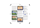
The Digital Map
In order to create just such an ‘intelligent’ map, a
lot of work must first be carried out. It begins with
registering all streets and striking points in the
landscape. To this end, aerial photos and satellites
are used. Then these roads are allotted specific
characteristics in order to distinguish them from
THE SMART CHOICE IN PERSONAL NAVIGATION
3.6113_TT GO Manual UK v7 22-04-2004 12:42 Pagina 18