


Magellan eXplorist Settings
Magellan eXplorist 310 User Manual 27
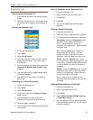
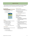
Toggling POI Waypoints (On/Off)
1. Access the Settings Menu.
2. Select the Map Options button.
3. Select the POI drop-down menu and select if
POI waypoints will be displayed on the map.
Selecting Current Location Icon
When Smart Arrow is selected the current location
icon will change color, indicating how well you are
on course to reach your destination.
1. Access the Settings Menu.
2. Select the Map Options button.
3. Select the Current Location Icon drop-down
menu and select Smart Arrow or Standard
Arrow.
Toggling Auto Zoom (On/Off)
Auto Zoom automatically sets the map scale to
best display the active route.
1. Access the Settings Menu.
2. Select the Map Options button.
3. Select the Auto Zoom drop-down menu and
select On or Off.
Map Draw Mode
1. Access the Settings Menu.
2. Select the Map Options button.
3. Select the Map Draw Mode drop-down menu
and select Exclusive or Hybrid.
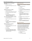
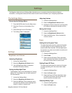
Units (Units of Measure)
Setting Distance Units of Measure
1. Access the Settings Menu.
2. Select the Map Options button.
3. Select the Distance drop-down menu and
select the desired units of measure.
Setting Speed Units of Measure
1. Access the Settings Menu.
2. Select the Map Options button.
3. Select the Speed drop-down menu and select
the desired units of measure.
3. Select the Origin Destination Line drop-down
menu and select if the line will be displayed on
the map when a route is active.
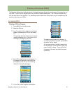
Toggling Track Lines (On/Off)
1. Access the Settings Menu.
2. Select the Map Options button.
3. Select the Show Tracks drop-down menu and
select if track lines will be displayed.
Setting Map Detail Level
1. Access the Settings Menu.
2. Select the Map Options button.
3. Select the Map Detail drop-down menu and
select the level of detail that will be displayed
on the map.
Toggling Topo Lines (On/Off)
1. Access the Settings Menu.
2. Select the Map Options button.
3. Select the Topo Lines drop-down menu and
select if topo lines will be displayed on the
map.
Setting Shaded Relief Level
1. Access the Settings Menu.
2. Select the Map Options button.
3. Select the Shaded Relief drop-down menu and
select how the map will display shaded relief.
Setting Geocache Waypoints Display Criteria
1. Access the Settings Menu.
2. Select the Map Options button.
3. Select the Geocache drop-down menu and
select what criteria will be used to select which
geocache waypoints will be displayed on the
map.
Setting Waypoint Display Style
1. Access the Settings Menu.
2. Select the Map Options button.
3. Select the Waypoints drop-down menu and
select how waypoints will be shown on the
map (Icons, Name and Icons, or Off).