


12 Magellan MAP 330 GPS Receiver
Basic Operation
Basic Operation
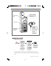
Because the MAP 330 attains information it needs from
satellites orbiting the earth, the antenna needs to have a
relatively unobstructed view of the sky. This allows the
MAP 330 to choose from all satellites currently available.
If the view of the sky is poor, (large cliffs or buildings, heavy foliage or other
obstructions) the satellite signals can be blocked and the receiver may take
longer to compute a position fix.
You can observe the signal strength and the satellites being used on the
Satellite Status screen (described in the next section).
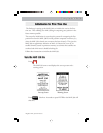
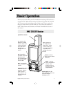
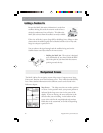
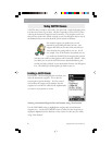
Holding the MAP 330. The receiver is designed
to fit comfortably in your hand. Hold the MAP
330 in the palm of your hand with the antenna
pointing towards the sky.
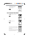
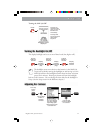
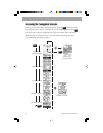
The MAP 330 has five navigation screens: Map screen, Compass screen, Large
Data screen, Position screen and Sat Status screen. They will be described briefly
here. More detailed information on the different screens can be found in the
Reference chapter.
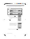
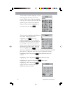
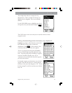
Map Screen . The Map screen has two modes, position
or cursor. In the position mode, your present position is
indicated by the large arrow icon in the center of the
display. If you are moving, the arrow will point in the
direction that you are heading. At the bottom of the
screen is the scale for the map displayed and two data
fields that can be customized, or turned off, depending
upon your needs.