


37Magellan SporTrak GPS Receiver
Reference
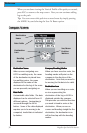
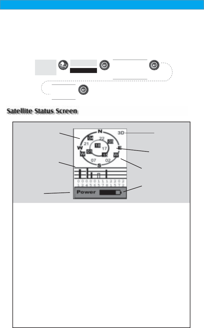
Satellite
Position
Satellite
Position Graph
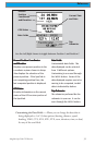
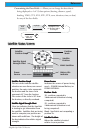
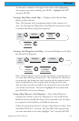
Battery Life
Indicator
Satellite Signal
Strength Chart
Power
Source
Satellite Position GraphSatellite Position Graph
Satellite Position GraphSatellite Position Graph
Satellite Position Graph
The two circles indicate satellite
elevation as seen from your current
position; the outer circle represents
the horizon and the inner circle
represents 45° from the horizon.
The center of the circle is 90° from
the horizon, or directly overhead.
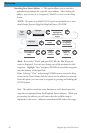
Satellite Signal Strength ChartSatellite Signal Strength Chart
Satellite Signal Strength ChartSatellite Signal Strength Chart
Satellite Signal Strength Chart
Clear bar indicates that the SporTrak
is starting to get information from
the satellite. Satellites that are being
used to compute your position are
shown with solid bars. The height of
the bar indicates the relative signal
strength.
Power SourcePower Source
Power SourcePower Source
Power Source
Indicates the source of power being
used — POWER (Internal Battery) or
POWER EXTERNAL.
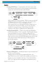
Position ModePosition Mode
Position ModePosition Mode
Position Mode
3D - position computed is
3-dimensional (elevation is being
computed).
2D - position computed is
2-dimensional (elevation is not
being computed).
Blank - SporTrak is not computing a
position fix.
Satellite PositionSatellite Position
Satellite PositionSatellite Position
Satellite Position
Where the satellite is located
relative to your position.
Position
Mode
WAAS Satellites
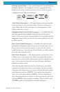
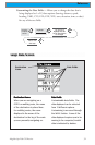
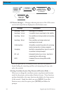
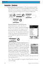
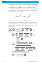
Customizing the Data Fields — Allows you to change the data that is
being displayed to 1 of 13 data options (bearing, distance, speed,
heading, VMG, CTS, ETA, ETE, XTE, turn, elevation, time, or date)
for any of the four fields.
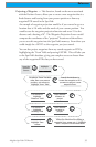
From the
Road
Screen
Highlight
Customize
Use arrows to
highlight the title
for the data field to
be changed
Use arrows to
select new
data type