


35Magellan SporTrak GPS Receiver
Reference
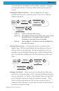
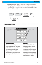
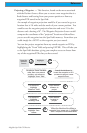
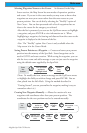
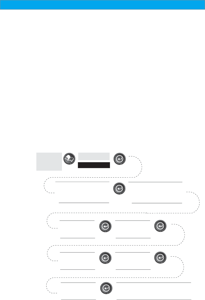
Projecting a Waypoint — This function, found on the menu associated
with the Position Screen, allows you to create a new waypoint that is a
fixed distance and bearing from your present position or from any
waypoint/POI stored in the SporTrak.
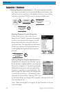
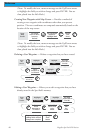
An example of waypoint projection would be if you wanted to go to a
location that is 2.0 miles and due north of your current position. You
would access the waypoint projection function and enter 2.0 as the
distance and a bearing of 0°. The Waypoint Projection Screen would
compute the coordinates of the “projected” location and then allows
you to save this waypoint into the SporTrak’s memory. From there you
could simply do a GOTO to the waypoint you just created.
You can also project waypoints from any stored waypoint or POI by
highlighting the “From” field and pressing ENTER. This will take you
to the SporTrak’s database, giving you complete access to choose from
any of the waypoints/POIs that you have stored.
From the
Position
Screen
Highlight
Projection
To select a “From” location
other then your present
position, use arrows to
highlight “From” field
Search the database to
locate the waypoint or POI
you want to project a new
waypoint from.
Use arrows to
highlight
“Distance” field
Enter desired
distance to
project
Use arrows to
highlight
“Bearing” field
Enter desired
bearing to
project
Use arrows to
highlight “Save
button
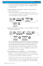
Follow the directions for editing a
waypoint (icon, name, etc.). Highlight
“Save” and press ENTE when done
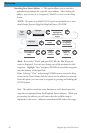
Follow the directions for editing a
waypoint (icon, name, etc.). Highlight
“Save” and press ENTER when done