


20 Magellan SporTrak GPS Receiver
Reference
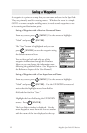
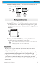
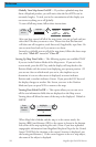
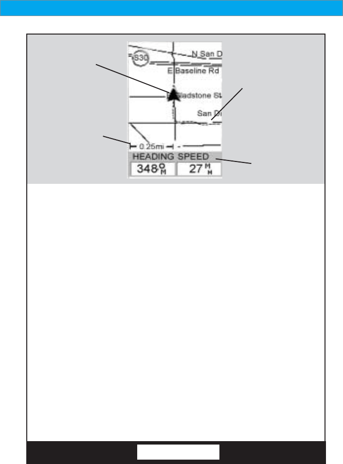
Map Scale
Indicator
Present
Position Icon
Present Position IconPresent Position Icon
Present Position IconPresent Position Icon
Present Position Icon
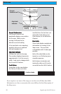
The Present Position Icon
graphically displays your position
on the map. While you are
moving it will point in the
direction you are heading.
If the SporTrak is not computing
positions, this icon is replaced
with an hourglass icon.
Map Scale IndicatorMap Scale Indicator
Map Scale IndicatorMap Scale Indicator
Map Scale Indicator
Provides the scale for the map.
The number displayed represents
approximately 1/4 of the screen’s
width. Scale can be changed with
the IN and OUT buttons.
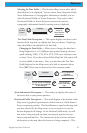
Track HistoryTrack History
Track HistoryTrack History
Track History
Dotted line on the map displays
the history of where you have
travelled since the last time you
cleared the Track History (see
Clear Memory in the Reference
Chapter.)
Data FieldsData Fields
Data FieldsData Fields
Data Fields
These fields display navigational
information for viewing on the
Map screen. They are both
customizable with 13 data types
possible.
Both of the data fields can be
turned on or off allowing more
viewable map area.
Both features (customize and
turning the data on/off) can be
accessed from the MENU button.
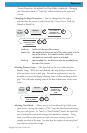
Data
Fields
Position Mode
Track History
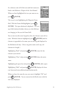
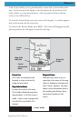
If you require to see more of the map you can also turn off these data fields.
Information as to how to customize this screen follows this brief description of
the Map screen.