


18 Oregon Series Owner’s Manual
Additional Tools
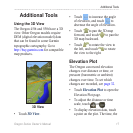
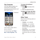
date, and the elevation recorded at
that point are shown.
Data elds
Distance or
time scale
1. Touch > one of the
data elds.
2. Touch a data type at the top of the
screen.
3. Select the data type from the list
of options.
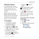
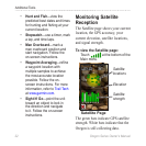
The Oregon can wirelessly share
waypoints, routes, tracks, and
geocaches with another wireless-
enabled Garmin recreational device.
1. Place the units within 10 feet (3
meters) of each other.
2. On the Main menu of both units,
touch .
3. On the receiving unit, touch
. The receiving unit
indicates when it is ready to
receive data.
4. On the sending unit, touch .
5. On the sending unit, touch the
category of data to send.
6. On the sending unit, touch an item
to send > .
7. Both units indicate that the
transfer is complete.
8. Touch on both units.