


16 zūmo 600 Series Owner’s Manual
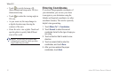
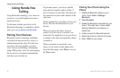
Where To?
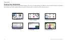
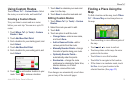
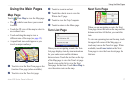
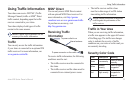
Touch to switch between a 3D
(three-dimensional) map and a 2D (two-
dimensional) map.
Touch to rotate the viewing angle in
3D view.
As you zoom out, the map changes to
a digital elevation map showing the
contours of the area.
Zoom far out to view a globe. Touch and
spin the globe to quickly nd different
areas of the world.
NOTE: You can only see detailed map
information for areas for which you have
maps loaded on your zūmo.
•
•
•
•
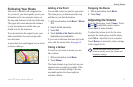
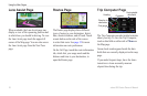
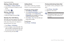
Entering Coordinates
If you know the geographic coordinates of
your destination, you can use your zūmo
to navigate to your destination using the
latitude and longitude coordinates (or other
coordinate formats). This can be especially
helpful when geocaching.
1. Touch Where To? > Coordinates.
2. Touch Format to select the correct
coordinate format for the type of map you
are using.
3. Touch a direction eld to select a new
direction.
4. Touch a numeric eld to enter the
coordinates, and touch Done.
5. After you have entered the proper
coordinates, touch Next.