


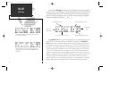
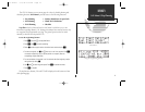

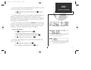


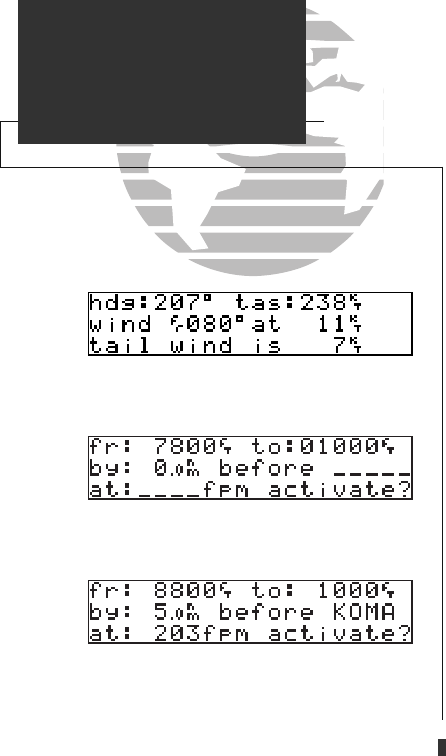
The GPS 165 will also perform winds aloft calculations to inform you of the direction
(true) and speed of the wind. This will also inform you whether you are
flying with a headwind or tailwind, and its speed.
To calculate winds aloft:
1. Press
C
and use
O
to highlight ‘Winds?’. Press
E
.
2. Use
K
and
O
to enter your present heading in the ‘hdg:’ field. Press
E
.
3. Use
K
and
O
to enter your true air speed (TAS) in the ‘tas:’ field. If you have
calculated it using the GPS 165, it will be displayed as the default. Press
E
.
The direction, speed and magnitude of the winds aloft will now be displayed. If the GPS
165 is interfaced to a compatible Air/Data Sensor, these values will be calculated automatically.
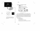
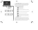
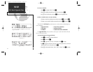
The VNAV function calculates vertical speed requirements to obtain a desired altitude
before or after a certain distance to a waypoint. This is helpful when you would like to
descend to a certain altitude near an airport, or climb to a certain altitude before reaching a
certain waypoint or NAVAID.
To calculate vertical navigation parameters:
1. Press
C
and use
O
to highlight ‘Vnav Plan?’. Press
E.
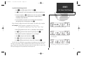
2. Use
K
and
O
to enter the initial (from) altitude (your present GPS altitude will appear as the
default altitude). Press
E
.
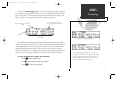
3. Use
K
and
O
to enter the desired final (to) altitude. Press
E
.
4. Use
K
and
O
to enter the distance from the waypoint. Press
E
.
5. Rotate
K
to select ‘before ’or ‘after’ the waypoint. Press
E
.
6. Use
K
and
O
to enter the waypoint identifier from the active route. If you are on a route, or a
direct-to, the active ‘to’ identifier will be displayed as default. Press
E
.
16
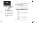
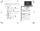
NAV KEY
NAV Menu 1/Winds Aloft/VNAV
Entering initial and final altitude.
Calculating winds aloft.
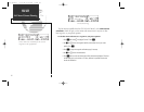
The recommended VNAV descent will be
displayed in the ‘at’ field.
165 manual 7/13/98 3:58 PM Page 16