


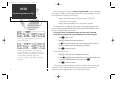


The Position page also features a reference waypoint field, located at the bottom
of the page, to indicate your radial and distance from a selected waypoint. The refer-
ence waypoint field can display the following:
• Range, radial and identifier of the nearest airport, VOR, NDB,
intersection or user waypoint
• Range, radial and identifier from a user specified waypoint
The default setting is to display the nearest airport. During DME arc approach opera-
tions, the reference waypoint field will automatically display the DME reference as long as
the active to waypoint is part of the DME arc.
To change the reference waypoint field to display the nearest airport, VOR, NDB,
intersection, user waypoint or the range and radial from a user selected waypoint:
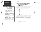
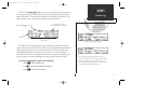
1. Press
C
to obtain a cursor.
2. Rotate
O
to highlight the proximity field after the
f
r.
3. Use
K
to choose which waypoint type you would like displayed. (Choose ‘wpt’ if you
would like a specific waypoint range and bearing to be displayed.)
4. Press
C
to remove the cursor, or:
If you have selected ‘wpt’:
5. Rotate
O
to advance the cursor to highlight the identifier field.
6. Use the
K
and
O
knobs to enter the identifier name. (This waypoint identifier can be
an airport, VOR, NDB, intersection or user waypoint.) Press
E.
7. Press
C
to confirm the selection.
This allows any waypoint’s distance and radial to be listed on the Position page
continuously. This is especially useful when trying to locate your position on a
sectional or when an approach reference is not the closest navaid.
12
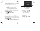
NAV KEY
Position Page/Reference Wpt
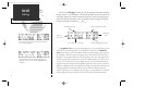
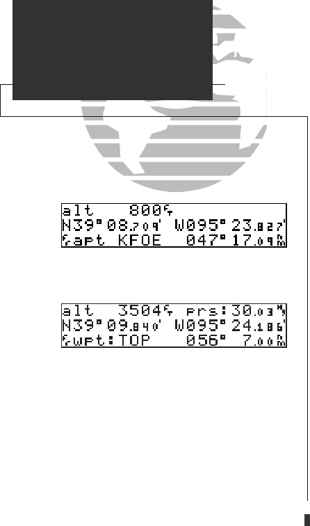
Position page displaying the TOP VOR as the
reference waypoint. This configuration is used to
monitor your distance and radial to the reference
waypoint during DME ARC approaches.
See Section 4 for more information on approach
operation.
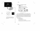
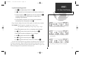
Position page displaying KFOE airport as the
reference waypoint.
165 manual 7/13/98 3:58 PM Page 12