


8
GPSmap 60
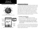
GPS Navigation
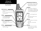
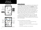
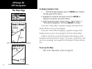
The Map Page
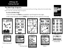
The Map Page
Position Arrow
The Map Scale
The Map Page with Data Fields and Guidance Text
“Track Up”
Mode
North
Orientation
Arrow
Data Fields
Guidance Text
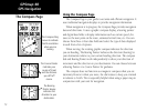
“North Up”
Mode
with Map
oriented with
North at the top
Street Level
Detailed
Mapping
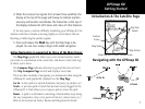
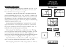
Using the Map Page
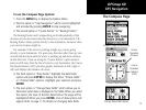
The Map Page is the primary navigation feature of the GPSmap 60.
The
Map Page displays a detailed map of the area surrounding your current
location. It allows you to pan the map with the ROCKER key and view
your progress when navigating. When in the “Track Up” mode (oriented
in the direction of travel), a north reference arrow appears at the top left
corner to orient the map. When in the “North Up” mode the map is
oriented like a paper map. When you activate the
Track Log feature, your
path of movement is indicated by a dotted line. The map display can be
changed to “Night” mode for easier viewing in dim light. The factory set
default automatically changes the display at sunrise and sunset.
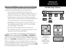
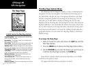
The map also displays geographic details such as rivers, lakes, high-
ways and towns. The maps to the left show a higher level of detail than
the basemap provided with the unit (i.e. residential streets, parks, etc.)
because Garmin MapSource
®
detailed mapping data has been downloaded
from a CD-ROM program.
You can use the Map Page to do the following:
• Determine your current location and progress while moving.
• Select and save a map point as a waypoint.
• Locate and navigate to map items by following a Route displayed
on the map.
• Customize the map display to your requirements.