Zooming, Panning, and Configuring (cont.)
From the waypoint definition page, you can also
define how each individual waypoint is displayed on
the map. The GPS 126/128 displays waypoints as a
name with a corresponding symbol (e.g., “nearest fuel”
and a gas pump symbol), a symbol only (e.g., a fish
symbol), or a 16-character comment and corresponding
symbol (e.g., “great view” and the camp site symbol).
The waypoint name has a six character limit while the
‘comment’ field has a 16-character limit, and there are
16 individual waypoint symbols available.
To select a waypoint display option:
1. Highlight the symbol field (to the right of the name
field), and press
F
.
2. Move the cursor to the ‘display’ field, and press
F
.
3. Select one of the following display options: ‘name with
symbol,’ ‘symbol only,’ or ‘comment with symbol and
press
F
.’
4. Press
F
to confirm the ‘DONE?’ prompt.
5. Press
F
again (on the waypoint definition page) to
return to the Map Page.
The last function you can perform with a waypoint
highlighted on the Map Page is to perform a GOTO
directly to the waypoint.
To go to a waypoint highlighted on the Map Page:
1. Press
G
.
2. Press
F
to confirm the GOTO waypoint page.
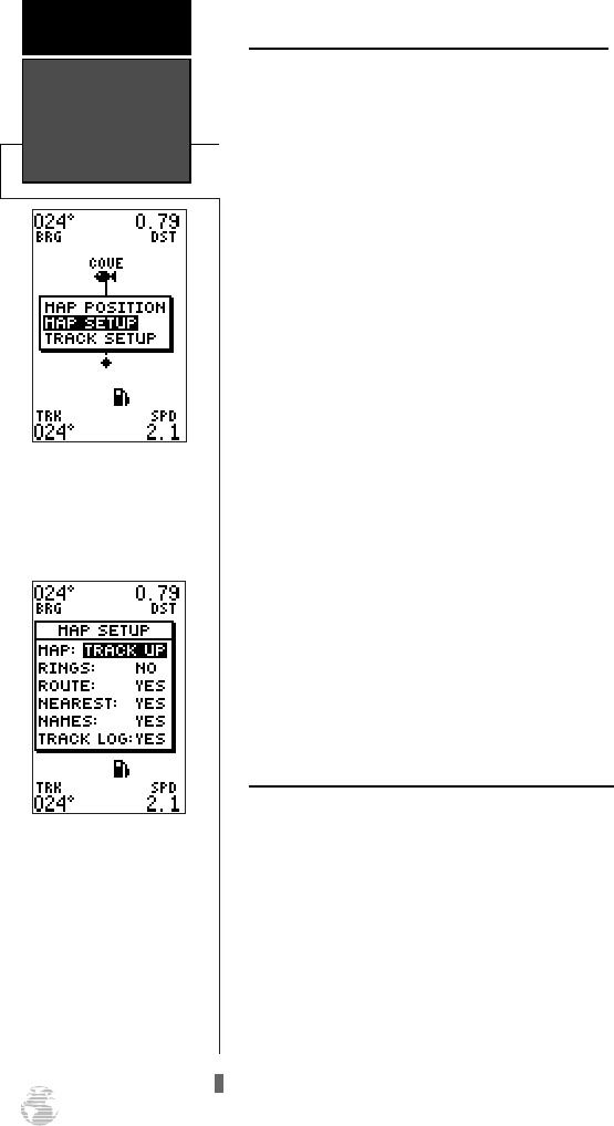
Accessing Map Setup/Track Setup Windows
You can access two additional pages—the map
setup page and the track setup page—from the Map
Page. Make sure that no waypoints are highlighted on
the map and press
F
. The Map Page option menu
will appear.
To select map setup or track setup:
1. Highlight the desired choice, and press
F
.
Using Cursor &
Map/Track Setup
REFERENCE
40
The map setup window
gives access to the map
setup and track setup
pages right from the Map
Page.
The Map Page’s default
screen orientation is track
up. “Track Up” means
that your current direction
of travel is always up (or
toward the top of) the
screen. It can also be set
for north up or desired
track up orientation.
126/128 Manual (new) 6/15/98 9:51 AM Page 40