


1. OPERATION
1-18
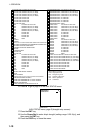
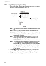
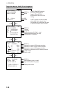
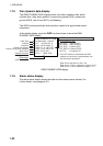
Target data display, AtoN (Aid to Navigation)
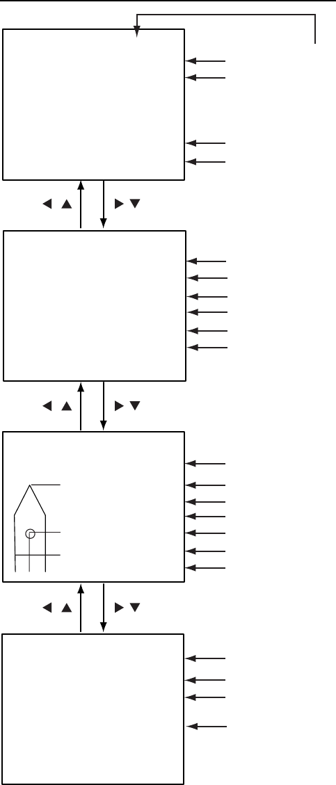
[DETAILS AtoN] 1/4
MMSI : 431099806
NAME: FURUNO
CPA : 0.02 nm
TCPA : 0'17"
CPA
MMSI No.
Name
TCPA
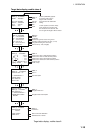
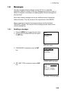
[DETAILS AtoN] 2/4
MMSI : 431099806
LAT : 34
°
03.5442'N
LON : 134
°
30.3883'E
PA : H
R/B : 25.12 nm/351.5
°
PI : ON POSITION
Range and bearing from own ship
Off Position or On Position
Latitude
Longitude
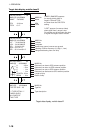
[DETAILS AtoN] 3/4
MMSI : 431099806
MMSI No.
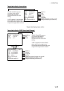
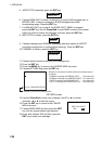
[DETAILS AtoN] 4/4
MMSI : 431099806
VIRTUAL AtoN
TYPE OF AtoN: 20
****TYPE OF DETAIL****
CARDINAL MARK N
Type of AtoN (See next page.)
MMSI No.
AtoN existence (real or virtual)
A : 100 m
B : 23 m
C : 6 m
D : 6 m
LENGTH: 123 m
BEAM : 12 m
Distance from bow to GPS antenna position
Distance from stern to GPS antenna position
Distance from port to GPS antenna position
Distance from starboard to GPS antenna position
Length of ship
Beam of ship
"DNGR" (DANGER) appears
(in reverse video) when a
target's CPA and TCPA
are lower than the CPA/TCPA
setting.
"LOST" appears (in reverse video)
when signal from a target is lost.
Six minutes and 40 seconds after loss
of signal the target's data is erased.
Position Accuracy (H, High, L, Low)
A
B
C D
MMSI No.
Description of AtoN