


3. PLOTTER OPERATION
3-27
3.8 Waypoints
In navigation terminology, a waypoint is a particular location on a voyage whether it be a
starting, intermediate or destination point. A waypoint is the simplest piece of information
your equipment requires to get you to a destination, in the shortest distance possible.
This unit has 999 waypoints into which you can enter position information. You may enter a
waypoint five ways: at own ship position, at MOB position (see page 1-13 for details), by
cursor, by range and bearing, and through the waypoint list (manual input of latitude and
longitude).
3.8.1 Entering waypoints
Entering a waypoint at own ship position
Press the SAVE/MOB key momentarily to store your position as a waypoint. This new
waypoint is saved to the waypoint list, under the youngest empty waypoint number.
Entering a waypoint with the cursor
1. Press the MENU key to open the menu.
2. Press the WAYPOINTS/ROUTES, WAYPOINTS and WAYPOINT BY CURSOR soft
keys. The plotter display appears.
3. Operate the Cursor pad to place the cursor where you want to enter a waypoint.
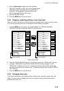
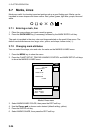
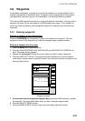
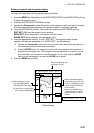
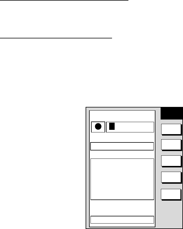
4. Press the NEW WPT soft key. The waypoint window appears and it shows waypoint
mark shape, waypoint name, comment (default: time and date), position of waypoint and
proximity alarm radius.
NEW
WPT
SELECT
MARK
COORD
TYPE
N < - -> S
E < - -> W
SAVE
RETURN
▲
34°44.000'N
135°21.000'W
359.9°
0.00nm
002WPT
00:00 01JAN00
34°44.000'N
135°21.000'W
359.9°
0.00nm
003WPT
00:00 01JAN00
34°44.000'N
135°21.000'W
359.9°
0.00nm
COMMENT
02:36 01JAN01
POSITION
LAT
34° 12. 134'N
LON
134° 12. 345'W
PROXIMITY ALARM RADIUS
0. 00nm
MARK
0 01WPT
NAME
Waypoint window
5. If you do not need to change the waypoint data, press the SAVE soft key to register
the waypoint. The steps which follow show you how to change waypoint data.
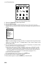
6. Press the SELECT MARK soft key.
7. Press the MARK SHAPE soft key to open the mark shape selection window.