


3. PLOTTER OPERATION
3-12
34 24. 3456 N 359.9 NU
124 24. 3456 W 59.9kt 024nm
+
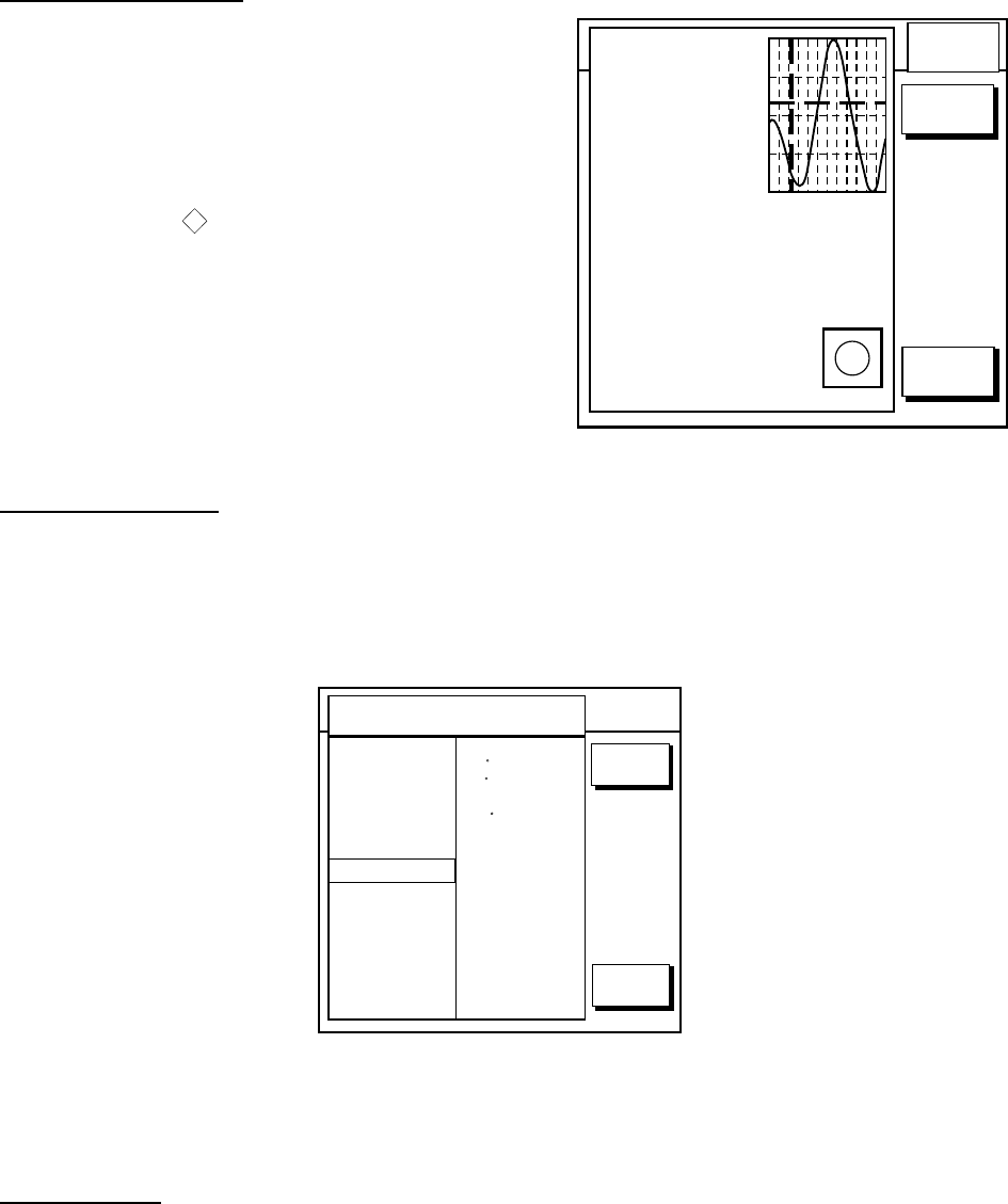
Time: 04:35
Speed (KT): 0.45ft
Angle ( ): 142
21/08/02 +00
Moonphase: FULLY IN 1 DAY
Sunrise: 05:03 Moonrise: 14:06
Sunset: 19:10 Moonset: 02:15
0.86
0.74
0.61
0.48
0.35
048
12
16 20 24
RETURN
DATE
Current
Max. Time Speed Aug. Slack
KT AT
Flood 4:58 1.2 323 7:58
Ebb 23:15 1.2 323 20:15
Flood 17:15 1.1 145 15:15
Ebb 23:15 1.2 323 20:15
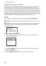
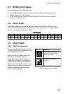
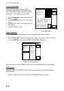
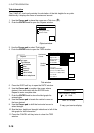
Current data display
Current (or tide) data
Some Navionics GOLD charts provide for
calculation of the current (or tide) data for any
date. Additionally it displays the time of sunrise
and sunset, moon shape (on current data.)
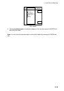
1. Use the Cursor pad to place the cursor on a
current icon (
T
).
2. Press the ENTER knob to show the current
window.
3. Press the DATE soft key, and then enter the
date desired.
4. Press the ENTER soft key.
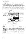
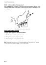
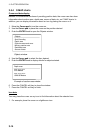
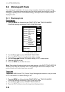
Object information
You can see detailed information about a place selected by the cursor as below.
1. Use the Cursor pad to place the cursor on the location you desire to know more about.
2. Press the ENTER knob to show the OBJECT INFORMATION window.
34 24. 3456 N 359.9 NU
124 24. 3456 W 59.9kt 024nm
+
RETURN
FIND
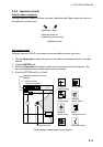
OBJECT INFORMATION
WRECKS
BLOCK AND TACKLE
BOATYARD
LAND AREA
DERDGED AREA
DEPTH AREA
POSITION
47 16.461'N
122 25.153'W
BRG. & RNG.
191 T 0.549nm
VALUE OF SOUNDING
62.2m
VERTICAL DATUM
MEAN SEA LEVEL
MOVE TRACKBALL <-/->)
Object information window
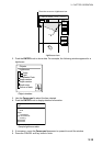
When there are two or more pages, roll the Cursor pad rightward to show the next page.
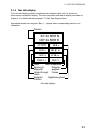
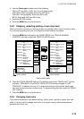
FIND function
When the OBJECT INFORMATION window is shown, objects can be listed according to
their categories.
1. Press the FIND soft key with the OBJECT INFORMATION window shown.