


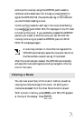
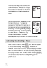
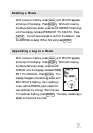
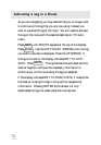
27
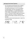
Changing Map Datums
If you are using a map (or chart) in conjunction with your
GPS 300 you need to insure that the datum used by the GPS
300 matches the one used in creating the map. The map
datum can usually be found in the legend box of the map or
chart. The GPS 300 offers the choices of WGS84 (default) or
NAD27.
Press the
MENU
key until SETUP is displayed at the top of
the screen and press
ENTER
. Use the RIGHT ARROW until
SETUP MAP DATUM is displayed. Press
ENTER
again, the
currently used map datum begins to flash. Use the RIGHT/
LEFT ARROWs to scroll through the list of map datums and
press
ENTER
when the desired datum is displayed.
Changing Distance Units
Your distance units can be in miles and miles per hour (MI-
MPH), nautical miles and knots (NM-KTS), or kilometers
and kilometers per hour (KM-KPH). To change the units,
press
MENU
until SETUP is displayed at the top of the screen
and press
ENTER
. Use the RIGHT ARROW until SETUP
UNITS is displayed. Press
ENTER
again and, the distance
unit of measure begins to flash. Use the RIGHT/LEFT
ARROWs to scroll through the list of units and press
ENTER
when the desired unit of measure is displayed.