


26
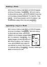
Changing Coordinate Systems
You may change the coordinate system that your GPS 300
uses to display the position and landmarks coordinates.
You have the following options: LAT/LON using degree/
minutes (DEGMIN), LAT/LON using degree/minutes/
seconds (DEGMINSEC) or Universal Transverse Mercator
(UTM), OSGB, Irish, Swiss, Swedish, Finnish, French, or
German. The choice you make will depend upon the maps or
charts you may be using. You want your GPS 300 to be
displaying the coordinates in the same mode that your map or
chart uses.
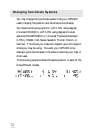
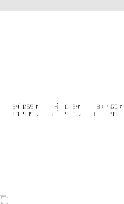
The following example shows the same position in each of the
three different modes.