


50
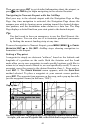
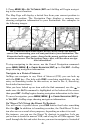
CDI display. However, the hollow (white) bearing arrow will continue
to point to the runway touchdown zone (TDZ).
The automatic route will be created and set to track inbound on the
extended runway's centerline from any distance from the airport. If you
desire, you can navigate to the notch of the fan for an approximate five
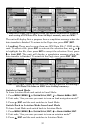
mile final approach. Just press
(FIND), select CURRENT ROUTE and se-
lect the LOC waypoint in the route.
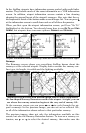
If you plan a short approach and want to bypass the use of runway cen-
terline guidance, and navigate directly to the runway threshold, you
can press
(FIND), select CURRENT ROUTE and select the TDZ waypoint
in the route.
When the Runway Approach Guidance feature is working, after passing
the TDZ the route sequences to the runway center, and then the airport
center. After landing and turning the AirMap off, this temporary route
is automatically deleted.
Tip:
For an even more complete runway guidance display, turn on the
"Markers" (outer marker) subcategory in the Aviation category. See
the Map Categories Drawn topic for more information.
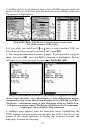
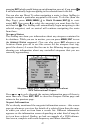
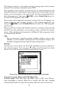
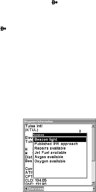
Services
The Services screen shows you all of the published services available at
the selected airport. You can press ↑ or ↓ to scroll through the listed
items, in case the list runs past the bottom of the screen.
Airport Services screen for KTUL (Tulsa International).
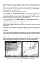
Transfer Custom Maps and GPS Data Files
Custom maps work only from the MMC card or SDC card. When a
card containing a Custom Map File is loaded into the unit, AirMap
automatically loads the map into memory when the unit is turned on.