


69
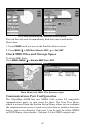
1. Press
MENU
|
MENU
|↓ to
S
YSTEM
S
ETUP
|
ENT
.
2. Press ↓ to
C
OMMUNICATIONS
P
ORT
|
ENT
|↓ to
C
ONFIGURE
NMEA
|
ENT
.
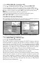
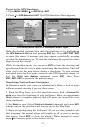
3. A menu appears showing the prefixes of the available NMEA sen-
tences. A check mark next to a prefix means the prefix is in use. Use ↑
↓ → ← to select a prefix, then press
ENT
to turn off the prefix. (Press
ENT
again to check the box and turn a prefix on.)
4. When the desired prefixes are checked or unchecked, press
EXIT
|
EXIT
|
EXIT
|
EXIT
to return to the previous page.
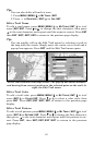
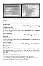
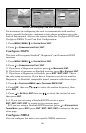
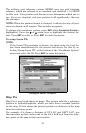
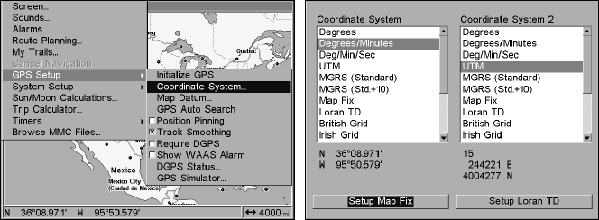
Coordinate System Selection
The Coordinate System Menu lets you select the coordinate system to
use when displaying and entering position coordinates.
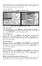
Menus for changing coordinate system used to display positions.
To get to Coordinate System Selection:
1. Press
MENU
|
MENU
|↓ to
GPS S
ETUP
|
ENT
.
2. Press ↓ to
C
OORDINATE
S
YSTEM
|
ENT
.
This unit can show a position in degrees (36.14952°); degrees, minutes
and thousandths of a minute (36° 28.700'); or degrees, minutes, seconds
and tenths of a second (36° 28' 40.9"). It can also show position in: UTM
(Universal Transverse Mercator) projection; MGRS (Standard); MGRS
(Standard + 10); Map Fix; Loran TD; British, Irish, Finnish, German,
New Zealand, Swedish, Swiss, Taiwan, Greek and Military grids.
UTM's are marked on USGS topographic charts. This system divides
the Earth into 60 zones, each 6 degrees wide in longitude.
British, Irish, Finnish, German, New Zealand, Swedish, Swiss, Taiwan,
and Greek grid systems are each the national coordinate system used
only in their respective countries. In order to use these grid systems,
you must be in the respective country. This unit will pick the matching
datum for you when you select the grid. See the entry on Map Datum
Selection for more information.