


37
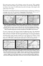
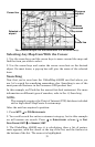
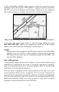
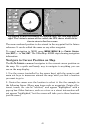
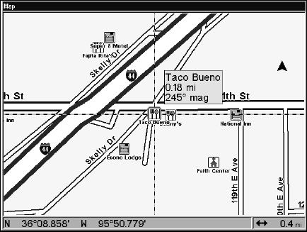
6. The GlobalMap 4000M's map appears, with the cross-hair cursor
highlighting the restaurant's POI symbol. A pop-up name box identifies
the POI, as well as its distance and bearing. A data box at the bottom of
the screen continues to display the location's latitude and longitude.
Map screen showing Find Waypoint, the result of a restaurant search.
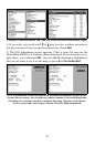
7. To clear the search and return to the last page displayed, press
EXIT
|
EXIT
|
EXIT
|
EXIT
. (Before you completely exited out of the Search
menus, you could have gone looking for another place.)
NOTE:
Search works from mapping and POI data loaded in the GlobalMap
4000M. If you do not have a high-detailed custom map (containing
POI data) for the area you are searching loaded on the MMC, you
may not find anything.
Set a Waypoint
A waypoint is simply an electronic "address," based on the latitude and
longitude of a position on the earth. A waypoint represents a location,
spot, or destination that can be stored in memory, then be recalled and
used later on for navigation purposes.
You can create a waypoint at the cursor position on the map, or at your
current position while you are navigating. You can create a waypoint at
any location by manually entering the position's latitude and longitude.
You can copy waypoints from your unit to your personal computer with
MapCreate software. When you want to repeat a trip, these archived
waypoints can be reloaded into your GPS unit.