


iii
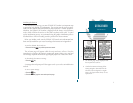
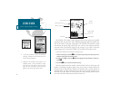
INTRODUCTION
Capabilities
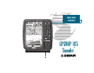
Designed for detailed electronic charting and complete depth sounding capabil-
ity, the GARMIN GPSMAP 185 Sounder is a powerful navigation device that can
also give you the fishfinding information you need in fresh or saltwater:
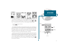
Precision Performance
High-contrast, four-level gray, LCD screen
PhaseTrac12 receiver tracks and uses up to 12 satellites simultaneously
for fast, accurate positioning
Differential-Ready just add the optional GBR 21 beacon receiver for better
than 5-meter accuracy
Gasketed case for use in exposed locations
Advanced Navigating and Plotting
250 alphanumeric waypoints with selectable icons and comments
Built-in worldwide database usable from 4096 to 64 nm scales
20 reversible routes with up to 30 waypoints each
Micro G-chart
TM
electronic charting with inland and offshore coverage
TracBack
TM
route feature which allows you to quickly retrace your track log to
a starting position
Built-in simulator mode
Superior Fishfinding Ability
Four zoom levels with a moving view window
Underwater waypoint marking
Map/Sounder split screen combines navigation and fishfinding information
Fish and depth alarms
Continuously shown digital depth display on all pages
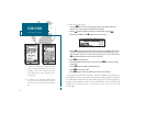
Warning
The GPSMAP 185 Sounder should not be used as a
navigational aid or depth sounder to
prevent collision, grounding, boat damage, or personal
injury. The digital depth displayed is the depth under
the transducer and not necessarily the front of the
boat. By the time a depth is displayed most of your
boat may have already passed over that area. We rec-
ommend that you operate the boat at very slow speed
if you suspect shallow water or submerged objects.