


16
To adjust the simulated boat speed:
1. Press the UP arrow of the
R
keypad to increase the speed in 5 knot/kph/mph incre-
ments. Press the DOWN arrow to decrease the speed in the same increments.
To steer the boat:
1. Press the LEFT and RIGHT arrows of the
R
keypad.
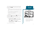
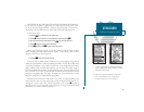
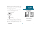
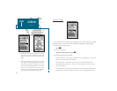
Notice that as you get off course, the highway and waypoint pointer move to
give you graphic guidance to get back on course. The scale in the lower right cor-
ner of the page represents the total distance (or the width) of the base of the high-
way display. The default graphic highway setting is 1/4 nm, but can be set for a
1/2-, 1-, 2- or 4-nm range.
To change the highway scale display:
1. Press either the C or D key to increase or decrease the map scale.
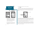
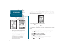
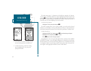
The navigation page data fields may also be configured to display any of eight
different navigation information categories. Lets change the ETE field to ETA
(estimated time of arrival).
To change a data field:
1. Press the
O
key to display the position page options.
2. Highlight the Change Data Fields? option and press
T
. The field highlight will now
appear in the top-left data field (the COG field).
3. Use the
R
keypad to move the field highlight to the ETE field and press
T
.
4. Highlight the ETA option and press
T
, and press
Q
to finish.
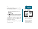
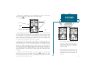
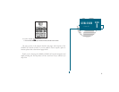
Now that youve seen the five main pages, lets look at the active route page,
which appears in the main page sequence whenever you are navigating a route:
1. Press the
J
key.
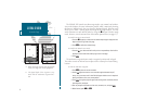
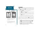
GETTING STARTED
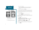
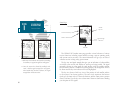
Using the Navigation Page
A
B
A. To reset the simulator to steer the desired
course automatically, select the Auto COG set-
ting from the options page.
B. The highway scale can be set to a 1/4-, 1/2-, 1-,
2-, or 4-nm/mi/km range with the ZOOM keys.