


AB
Using the Map Cursor
Working from the map page is a simple process that centers around the use of
the cursor. Controlled by the
R
keypad, the cursor is an important tool that can
be used to pan to other map locations, mark and edit waypoints and routes, and
review position data of on-screen navaids and waypoints.
To get a feel for using the map page and using the cursor, try the following
exercise:
1. Use the
C
key to set the map scale to the 64 nm setting. Your boat should be near the
center of the map, at the receivers last known position. (If your boat isnt where it
should be, make sure that you have initialized the receiver and acquired a position as
described on pages 1-2.)
2. Use the DOWN arrow of the
R
keypad to move the cursor down to the first lat/lon grid
south of your boats position.
3. Using the
R
keypad to move the cursor, try following the outline of the lat/lon grid clos-
est to your boat. Notice how another data field appears at the top of the page, showing
the bearing and distance from your boat to the cursor, along with the lat/lon of the cur-
sor.
4. Press the
Q
key to remove the cursor and recenter your boat on the map display.
As you become more familiar with the cursor, youll see that the map display
actively scrolls or pans, letting you explore areas around the world (even outside
of your current Micro G-chart coverage) and create waypoints and routes.
Wherever you move the cursor, youll always be just one
Q
keystroke away
from returning the map to your present position.
Now that you have a feel for how the cursor works, lets move on and see how
the GPSMAP 185 Sounder works on the water. To help you practice using the
map page and other features, weve stored a practice route in the receivers perma-
nent memory so you can see exactly what youll experience when youre navigat-
ing with your new GPS chartplotter.
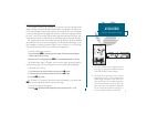
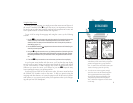
GETTING STARTED
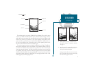
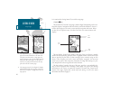
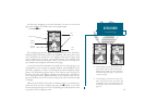
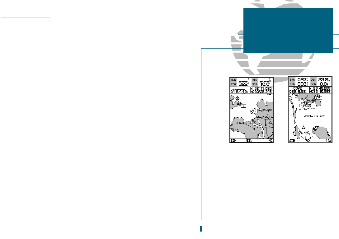
Map Cursor
A. Whenever the cursor is active, the bearing
and distance of the cursor from your present
position will appear in a pop-up data win-
dow. To remove the cursor and recenter your
vessel on the map, press the QUIT key.
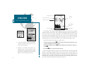
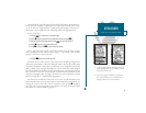
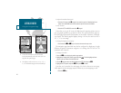
B. To select an on-screen waypoint, simply
move the cursor over the desired waypoint.
The waypoint/navaid name and position,
along with the bearing and distance from
your present position, will be displayed.
Note: Underwater waypoints are also shown
on the map.
11